OUR GREAT LAKES RV ROAD TRIP ADVENTURE - 2-WEEK UPPER PENINSULA ITINERAY
-
Hits: 3904
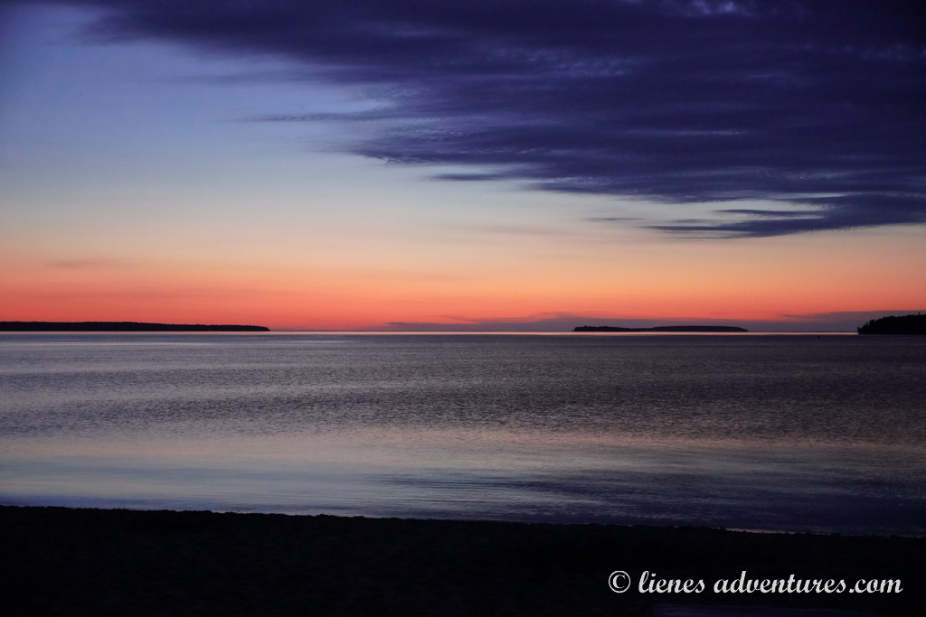
The Great Lakes are a chain of deep freshwater lakes in east-central North America comprising the lakes Superior, Michigan, Huron, Erie, and Ontario. Some even consider them to be inland seas. And I don’t think that would be far from the truth. Formed by melting glaciers during the last Ice Age, these lakes are deep, cold and vicious despite their inviting, turquoise blue Caribbean Sea-like appearance. During storms, the waves can gain height of 20 feet (6m), and Lake Superior can even exceed 30-feet (9m) wave height. How about that for a leisurely Sunday swim?!
The Great Lakes region had been on our radar for quite a few years, and we finally decided that it was about time we paid a visit to this part of the USA. While last summer our RV road trip took us to Yellowstone National Park, this summer was going to be all about the Great Lakes!
CUYAHOGA VALLEY NATIONAL PARK
Sat, June 21
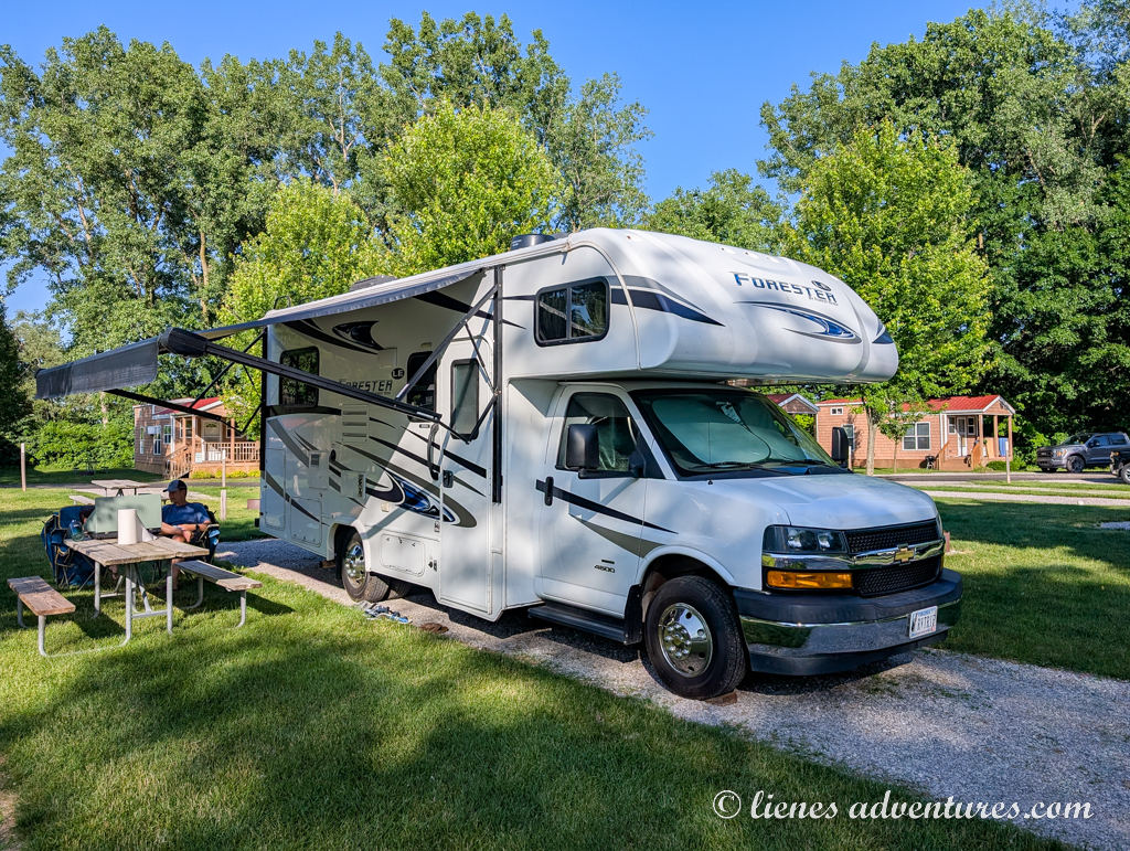
We started our trip from Virginia with a 380-mile (611km) drive to reach our first booked campground near Cuyahoga Valley National Park in Ohio. As it usually happens, between some traffic, gas stops, windy mountain backroads, and leg-stretches, the drive took longer than expected and we eventually reached our destination only 7 hours later. The boys had already come to expect our RV drives to last a while, and entertained themselves with books, games and an occasional SuperMario round on their Nintendo. They were also old enough now where we did not have to listen to “Are we there yet?” every 5 minutes. Maybe only every 15…
With our late arrival, we decided it was not worth trying to rush our visit to the park. It would be much more productive to postpone it till the next day. So, we ended up spending the evening at the campground instead. There was a swimming pool full of campground kids which was exactly what our boys needed after sitting still for 7 hours.
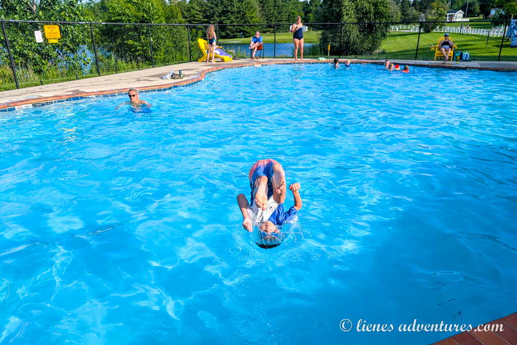
There were lots of flips, jumps, water fights and games, until the lifeguard blew the whistle at 9PM announcing the pool closing. It was time to finally settle down for our first night of the trip.
Sun, June 22
This morning, we got up a little earlier than originally planned. As we did not manage to see Cuyahoga Valley National Park the day before, we had to make up the time today.
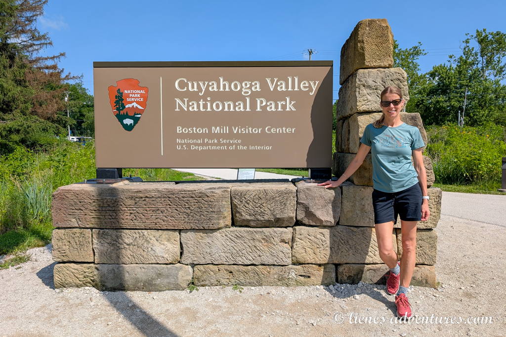
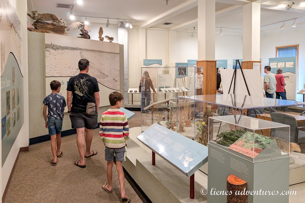
Our first stop was the park’s visitor center to get some trail information as well as pick up Junior Ranger booklets for the boys. Filling out booklets and earning their Junior Ranger badges had become a tradition of ours every time we visited a new park.
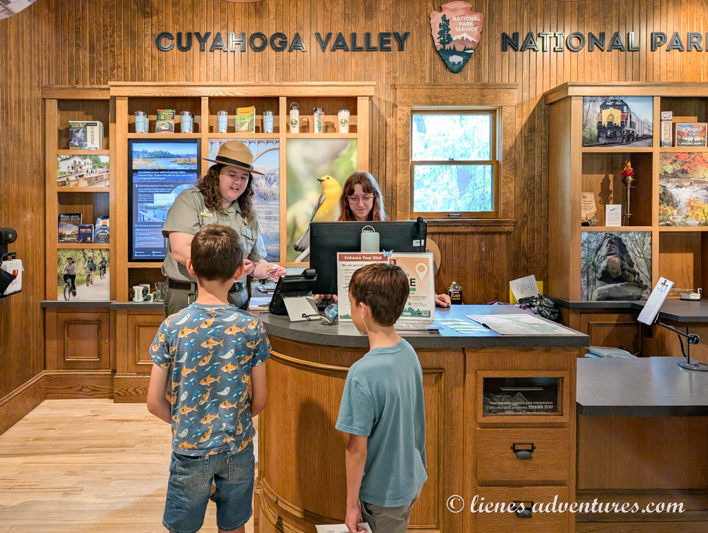
Afterwards, we headed on to our first trail of the trip – the 2-mile-long (3.2km) Ledges Trail. It circled a plateau of striking rock formations providing unique views along the way.
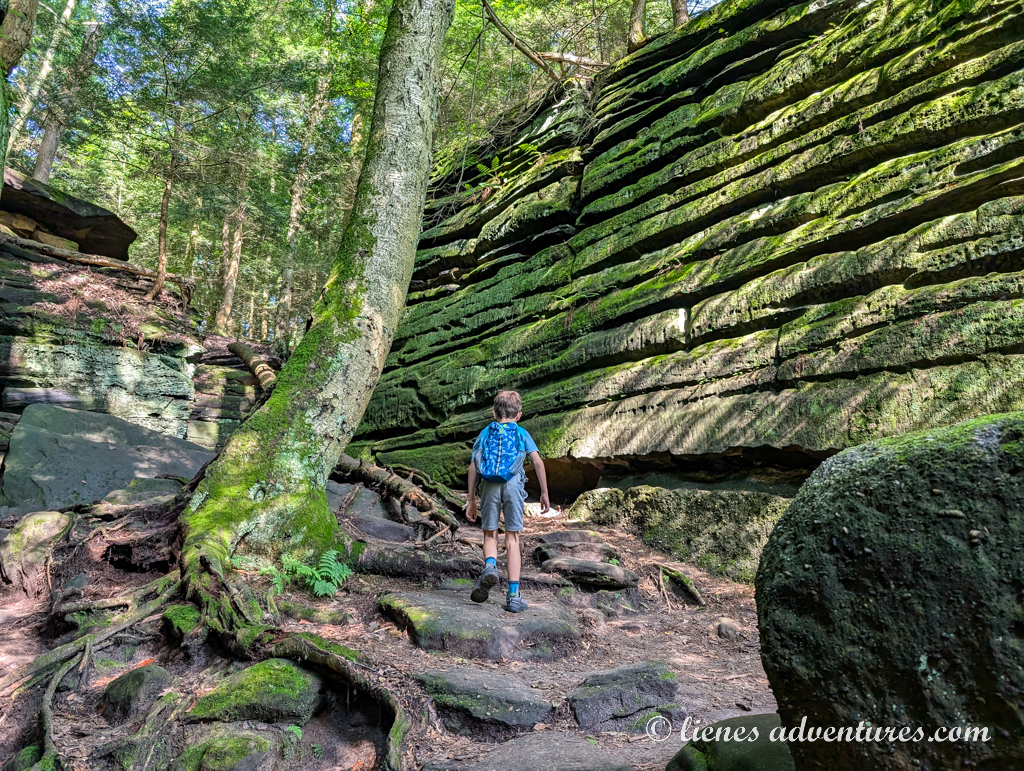
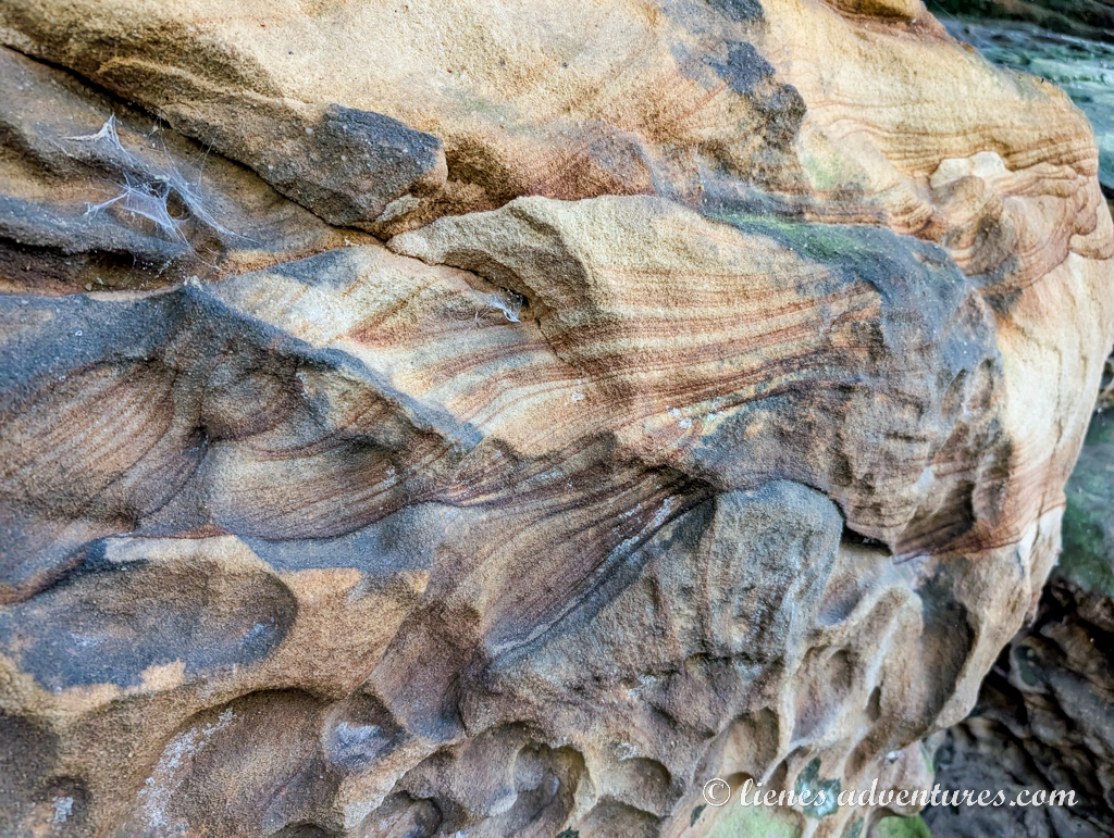
About 315-320 million years ago, fast-moving streams flowed through a steamy swamp area that was located here. The streams brought sand and pebbles along with them that formed the Sharon Sandstone and Conglomerate rock that we saw here. Upon closer inspection, many areas of the sandstone really looked like underwater reef formations…
The boys loved exploring all the nooks and crannies hiding around various corners. The mossy sandstone walls evaporated cool, moist air, giving us a little respite from the rapidly increasing temperatures.
Once finished, without much hesitation, we drove to our other trail of the day – the Brandywine Falls. This was the most popular (and therefore the most congested) area of the park. Lucky for us, there was a parking spot for our RV (despite the displayed parking sign stating there was no parking available). We grabbed our backpacks and headed out. Wooded boardwalks took visitors to a waterfall overlook platform. The falls were beautiful, and a welcome stray spray cooled off the onlookers.
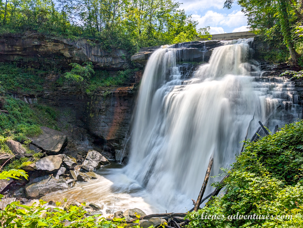
The day was getting hotter and hotter. It had to be 90 degrees (+32C) in the shade by now. We were sweating already and had walked barely half a mile. Besides, I had suddenly developed a pretty bad tendon cramp that basically made me hop on one leg. Taking all that into consideration, we abandoned our idea of hiking the rest of the trail and turned back to the car after seeing the waterfall. Everyone but me was happy with this new turn of events.
The busy morning had left us all hungry, so we had lunch right there in our RV, before starting the next leg of our trip. We were heading to Frankenmuth, which was about a 4-hour-drive away.
FRANKENMUTH, MICHIGAN
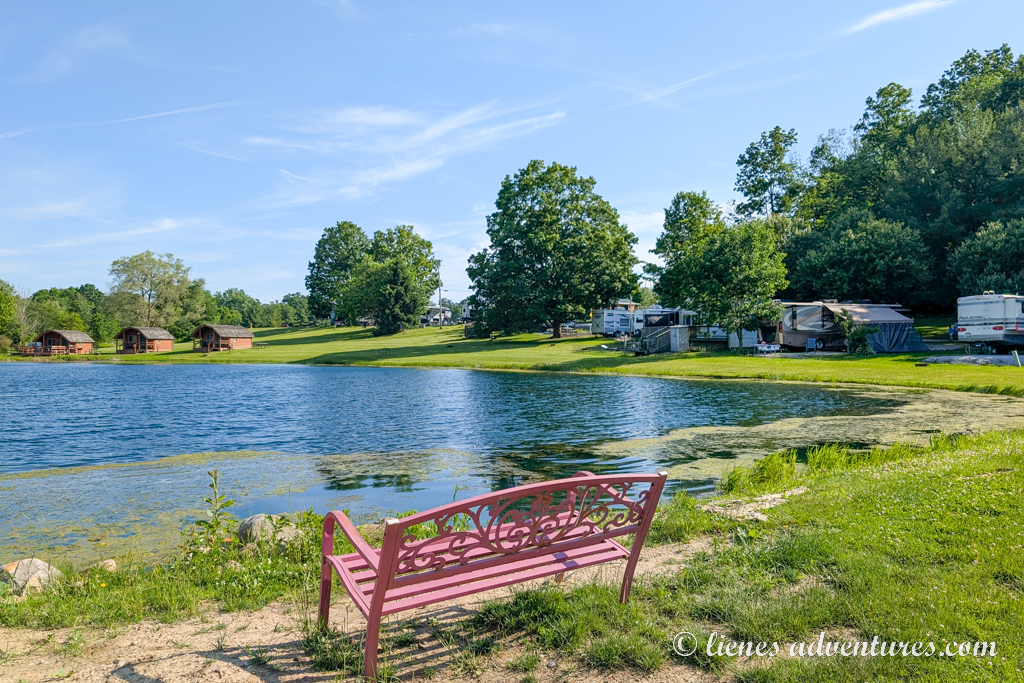
While Frankenmuth was a place my husband and I were looking forward to exploring, the kids were more excited about the campground. I had booked a campsite for us at Jellystone RV Park. This campground chain always had fun activities for kids – from swimming pools to game courts, and jumping pillows… And as the day had been long already, we were happy to just wind down for the evening and stay at the campground. The boys still had enough energy to spend a few hours at the pool, while I was equally happy to just sit on a poolside lounger doing absolutely nothing.
Overall, this trip wasn’t planned out to be quite as jam-packed with activities as we were used to on our travels. This time I had allotted plenty of time to have several free afternoons to just relax and take it easy while still managing to see all the sights on my list.
Mon, June 23
But what was so special about Frankenmuth? It was a city known for its Bavarian-style architecture and the area’s German roots. The area was settled and named by immigrants from Roßtal area of Franconia in Germany upon their arrival around 1845.
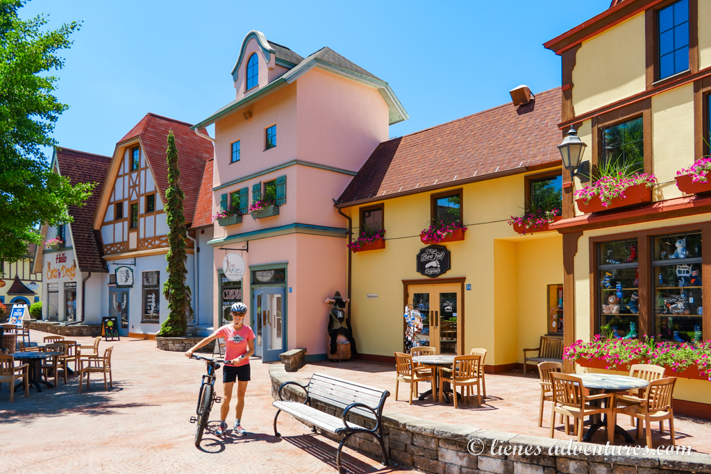
Having lived in Germany ourselves for several years, we were quite excited to explore this little town. As our campground was within town limits, we didn’t even need to drive anywhere. After breakfast, we hopped on our bikes and headed out for the day’s adventure.
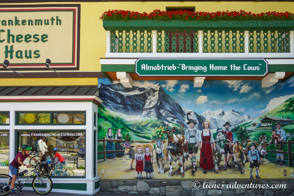
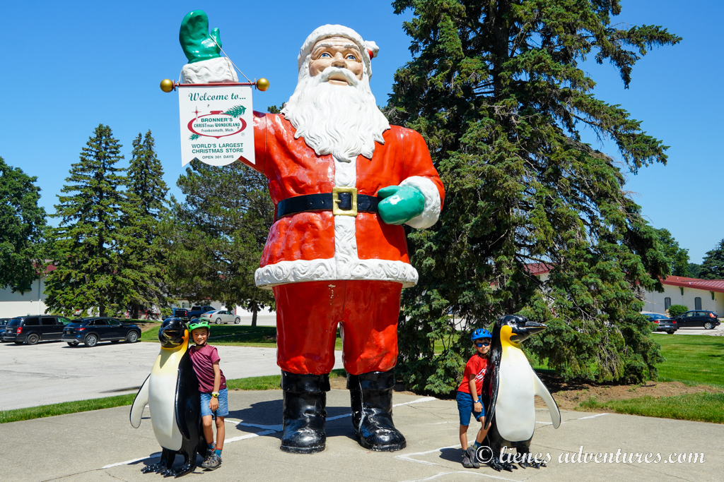
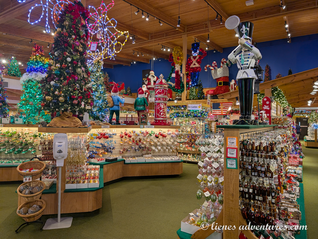
The first place we visited was quite a peculiar place to see in the middle of summer! It was Bronner’s Christmas Wonderland – the world’s largest Christmas store! Designed with an Alpine chalet architecture, the interior of the store spanned 7.35 acres (2.97 ha) in size with landscaped grounds covering 27 acres (11 ha). It is visited annually by over 2 million people! And now we could add ourselves to the visitor list!
We parked our bikes and headed inside. Cool, air-conditioned wintery breeze hit our senses immediately, with the smell of evergreens and pinecones lingering in the air. Decorations, advent calendars, gifts, tree ornaments and yard decorations, customizations and crafts… room after room, after room… It was unbelievable how truly huge this winter wonderland was! Although we had no need to buy anything, we spent over an hour just admiring the place and still did not see everything. There were so many little details to look at!
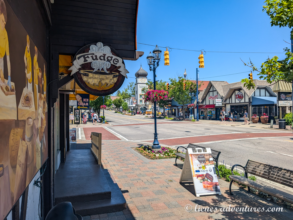
The second we exited the building; we got blasted with the 90-degree (+32C) swell again. Back to summer! We climbed aboard our trusted steel steeds and pedaled into the historic part of the town. Overall, it was very commercial, with every building being a shop, restaurant, café, retail store or an office. But it was still quite fun to bike around, look at the architecture and compare it to the one we saw in Germany years ago.
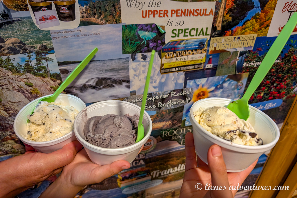
Because of the extreme heat, we consumed a lot of ice cream, iced coffees, bubble teas and any other item with “ice” in its description.
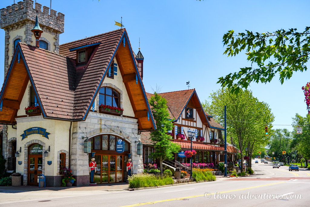
I had read good reviews about Bavarian Inn German Restaurant, so we decided that this would be the best place to get that perfect bite of a Jägerschnitzel or Wienerschnitzel. The decision was made, and it was a choice we did not regret! The food was great, and many of the traditional German sides were included as part of the family style dinner package. It brought back many fond memories for us. And there was so much food that lots of it we packed up to-go and ate for another 2 days afterwards! And the best part for the kids was when they found out that ice cream dessert came as part of the meal! Can’t beat that! And while they were “completely full” just a minute ago, somehow there was suddenly just enough room in their stomachs for the whole serving of ice cream. Funny how that works…
At the end of the day, we had biked around close to 10 miles (16km), seeing pretty much most of what the little town had to offer. I probably would not say that Frankenmuth was something one must go out of their way to see, but as we were passing through the area, it was a nice spot to break up the drive and spend a few days at.
SLEEPING BEAR DUNES NATIONAL LAKESHORE
Tue, June 24
Today we were driving 175 miles (280km) across the peninsula to the west, towards Sleeping Bear Dunes National Lakeshore. Although, a little delay in the morning pushed our timeline back by a few hours. Last night after dinner, I had planned to do some laundry at the campground. However, upon dragging our stinky laundry basket to the laundromat, I discovered that the machines were coin operated only. The office was already closed, and we only had 3 quarters – not nearly enough. So, we had to wait until 8:30 the next morning to go exchange some dollar bills at the office, and get our laundry done in the morning instead. Bad planning on my part, but that’s just camping life!
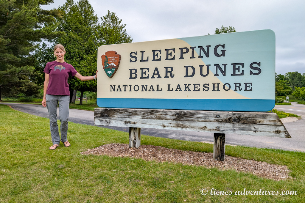
A couple hours late, but with fresh laundry and nice-smelling towels, we were back on the road again. Sleeping Bear Dunes was probably one of the parks on this trip I was looking forward to seeing the most. When planning the trip, I had seen pictures of large rolling sand dunes and turquoise water and it looked quite impressive.
We made it to the park right in time to check in at our campground. For the next 3 nights we were staying inside the park at Platte River Campground. It was the only park campground with electricity hook-ups, and I was lucky enough to snag a spot for 3 nights straight. While checking in, the boys also picked up a Sleeping Bear Dunes junior ranger booklet to earn their badges here.
We settled into our spacious campsite and started pondering what to do… National park campgrounds are fairly simple with no added extras (like Jellystone RV resorts with pools and game courts). Nature was the main attraction when visiting national parks. So that was what we were going to do! Just a walking distance away from the campsite was Platte River where visitors could rent kayaks or inner tubes and float down the river. It was a self-guided float with rental agents explaining to us where we needed to start and where to get out of the river, and how to walk back to the rental office after we were done. Sounded simple enough and off we went…
To my relief, the river was relatively shallow with most of it easily walkable (if needed). The boys had a ton of fun splashing and spinning, while my husband and I were trying to steer our tubes clear of fallen branches and snagging submerged logs. Based on my Garmin tracker, the float was about 1 mile (1.6km) long and took us around 40 minutes to complete, with a 10-minute walk back through the woods to the rental office. It was a fun activity!
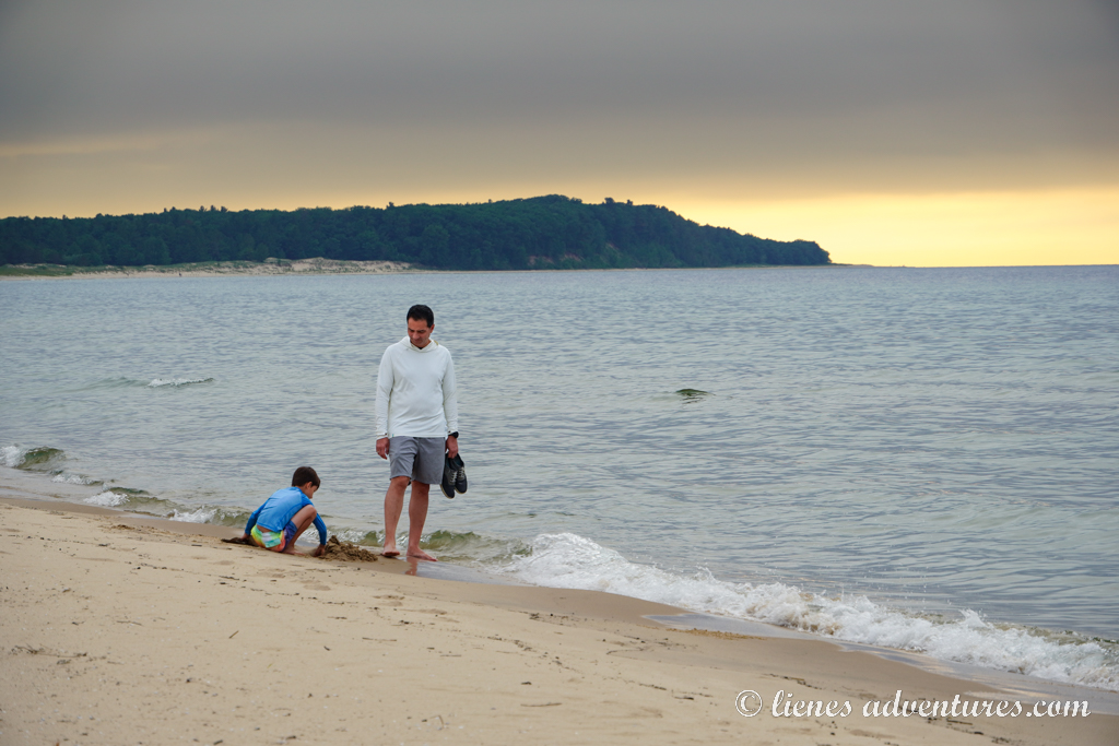
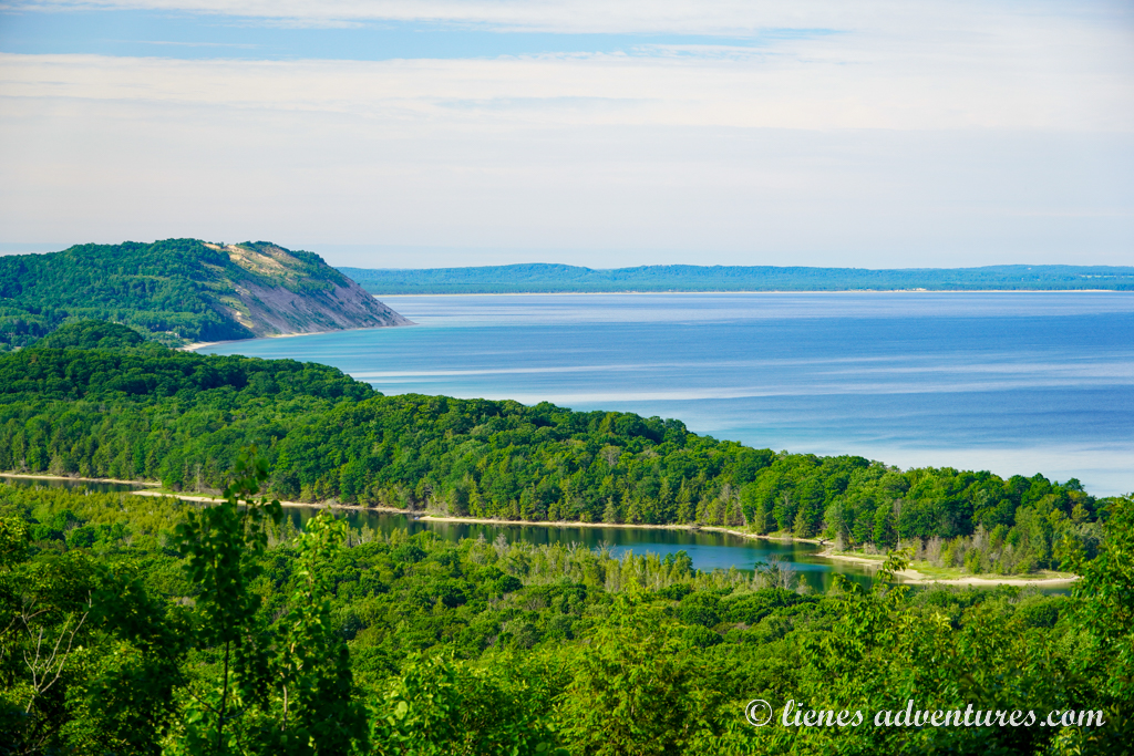
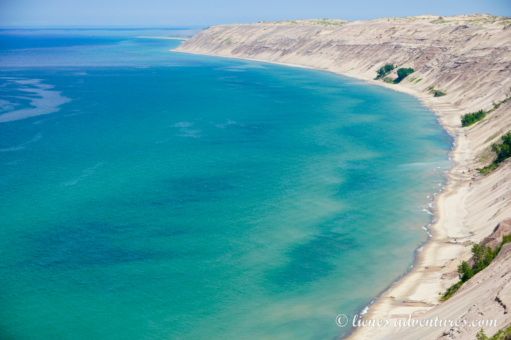
Upon returning to the campground, I insisted that we FINALLY had to go see what we came here for – the Great Lakes! Sleeping Bear Dunes was on the shores of Lake Michigan, and being a walking distance away, we headed there for the sunset.
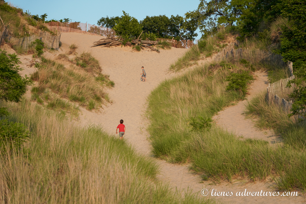
Once we exited the campground, the path turned into a wooded trail which eventually started giving way to a gradually increasing amount of sand. We had reached the shores of Lake Michigan! The boys took off and climbed the first dune they saw, rolling down it like rag dolls.
I, on the other hand, turned my attention to the vastness of the lake with steep cliffs in the distance.
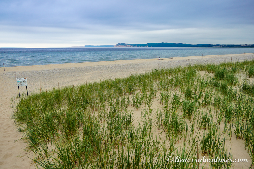
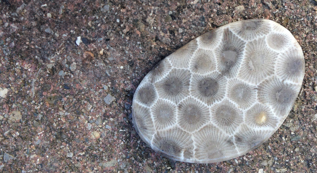
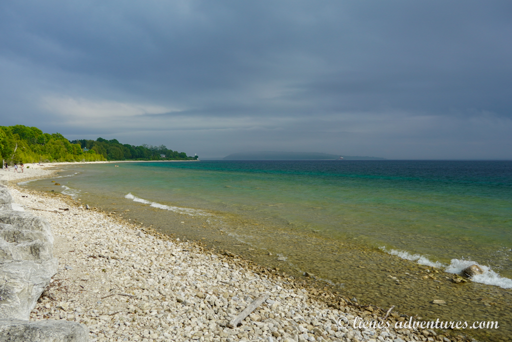
Unfortunately, due to very overcast and gray skies, it did not look like a very promising evening for a sunset. But we did not let that disappoint us and proceeded with a long walk along the shore. The water was ice cold, stinging my feet as I stepped in. The boys were very invested in trying to find Petoskey stones. They were fossilized coral from Michigan's ancient seas, featuring a distinctive hexagonal pattern. Petoskey stones were the official state stone of Michigan and could be found along the shores of Lake Michigan.
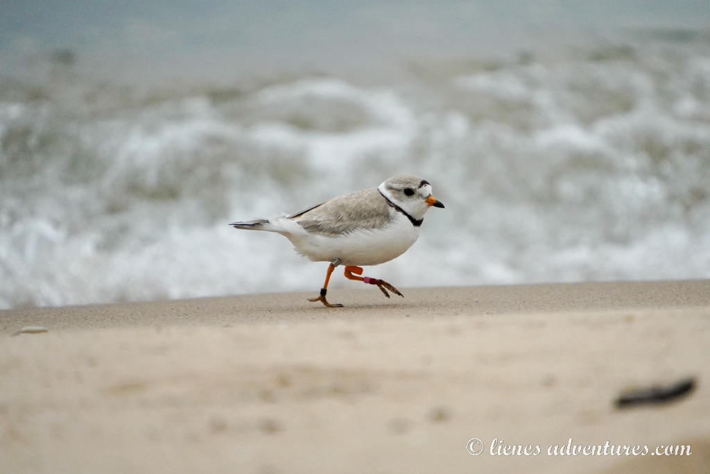
We also observed many piping plovers running around the sand. The shores of the Great Lakes were once home to nearly 800 pairs of piping plovers. In 1990 that number had dropped to 13. In 1986, the Great Lakes population of piping plovers was placed on the Federal Endangered Species list. Now their nests are protected, fenced off and large parts of the dunes are inaccessible during plover’s breeding season. So far, the population around the Great Lakes has increased to about 70 pairs.
As we were enjoying our evening walk, observing things around us, we had walked a loooong way from the campground and now had to walk a long way back. It was dusk and the mosquitoes were out in droves. We collected sticks and ferns and made some swatters just to avoid being eaten alive. In the end, our evening walk ended up being over 4 miles (6.5km) long by the time we reached the campground in half-dark.
Wed, June 25
With some storms threatening to roll in across the area over the next few days, we got up early to start our day. The weather forecast showed rain starting in the afternoon, so we wanted to squeeze in all the sightseeing before the storm could reach us.
By 7AM we had already had breakfast and were rolling towards the central part of the park. Our first activity was to complete the 8-mile-long (13km) Pierce Stocking Scenic Drive. It was a windy one-directional road with several pull-outs for scenic views. Coming here at 7AM also ensured that our RV would have enough room to park before the crowds showed up. I guess we were overachievers because we were the ONLY ONES on the drive this early in the morning. And it was perfect – quiet and tranquil!
We pulled into several of the overlooks, many of which had informational placards explaining the history of the area, the formation of the Lakes, and the ever-changing dune landscape.
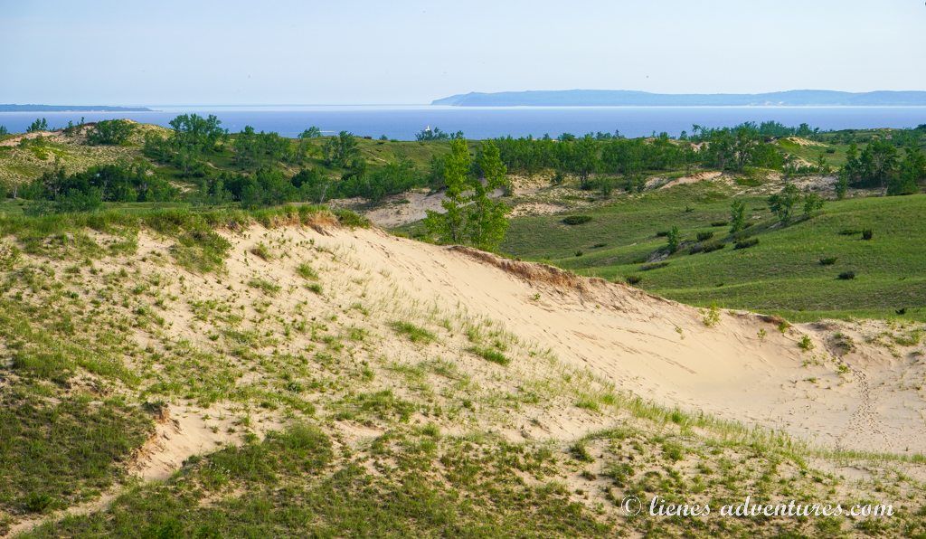
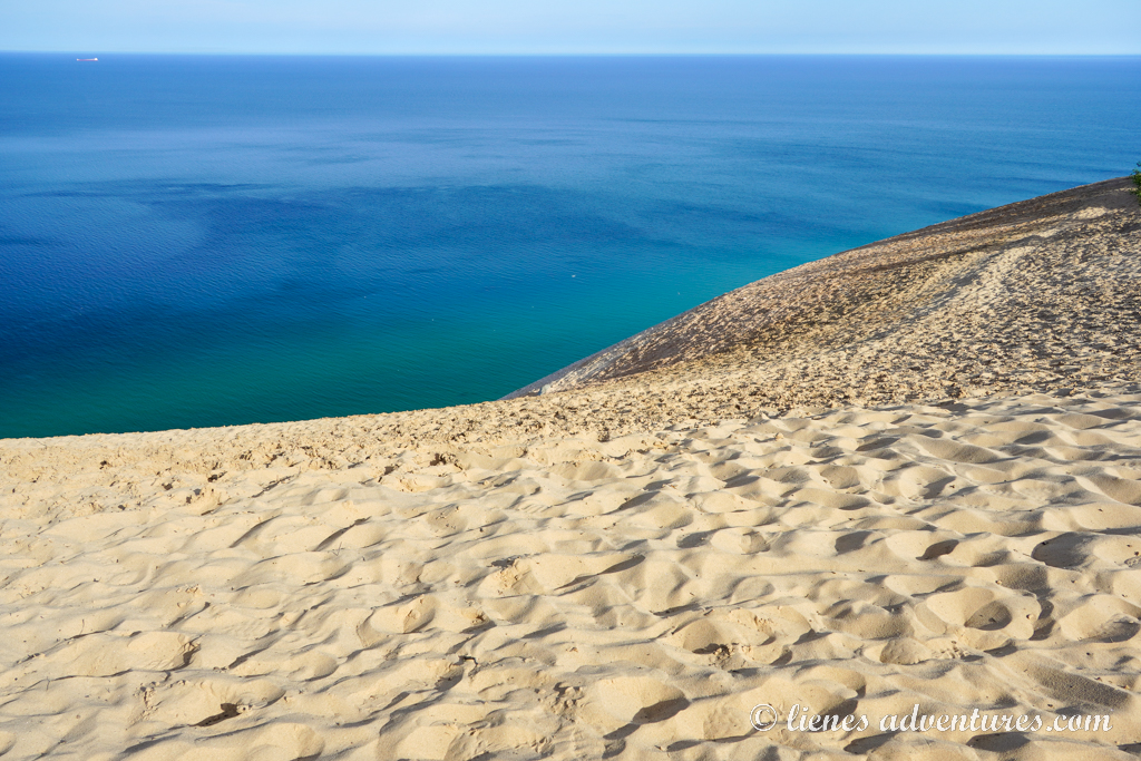
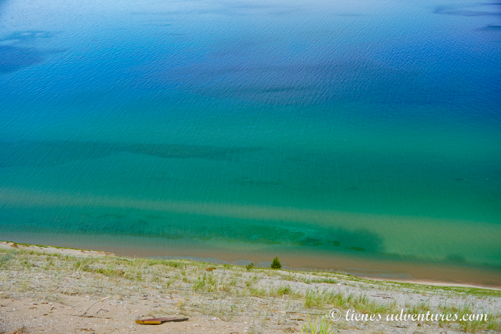
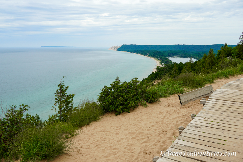
The most popular stop on the drive was Stop #9: Lake Michigan Overlook. Here, white sand dunes stood proudly 450 feet (137m) above the surface of the lake, giving vast views across in all directions. And we got lucky when some sun rays started peeking through the clouds, illuminating the tropical turquoise and emerald colors of the water. It was so pretty!
The boys, meanwhile, took the opportunity to get all sandy.
By the way, going down these dunes to reach the lake is not prohibited. But many do not realize how hard it could be to climb back up a 450-foot (137m) tall sand mountain. Quite a few rescues take place here every year, costing the daredevils exactly $3000 in rescue fees each time. The rescue involves a 10-member rescue team with a rope system. In 2024, 8 calls were made here and 4 needed rescues.
Our last stop on the Drive was the North Bar Lake Overlook which was different but equally beautiful. With no-one else around…
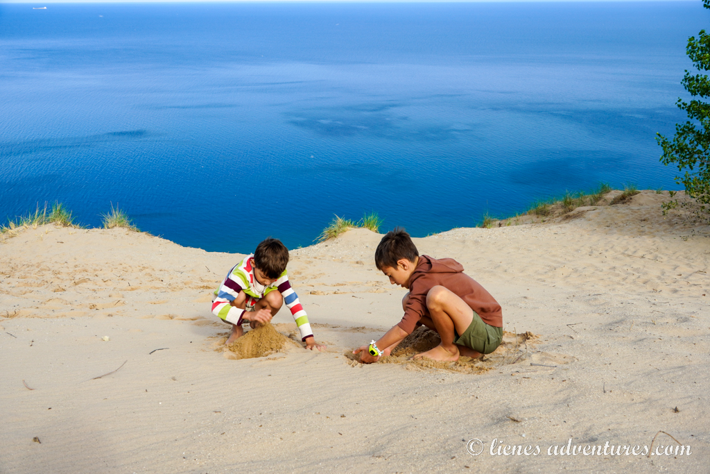
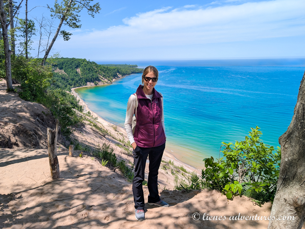
After completing the scenic drive, we pressed on to the most popular attraction of the Sleeping Bear Dunes National Lakeshore – the Dune Climb! This dune was finally the one which we could safely climb! As we rolled into the several hundred car large parking lot, there were only 5 cars here ahead of us and the vastness of the whole dune belonged to just us! It really pays off to force ourselves out of bed early!
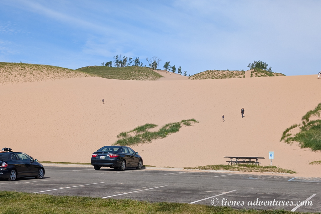
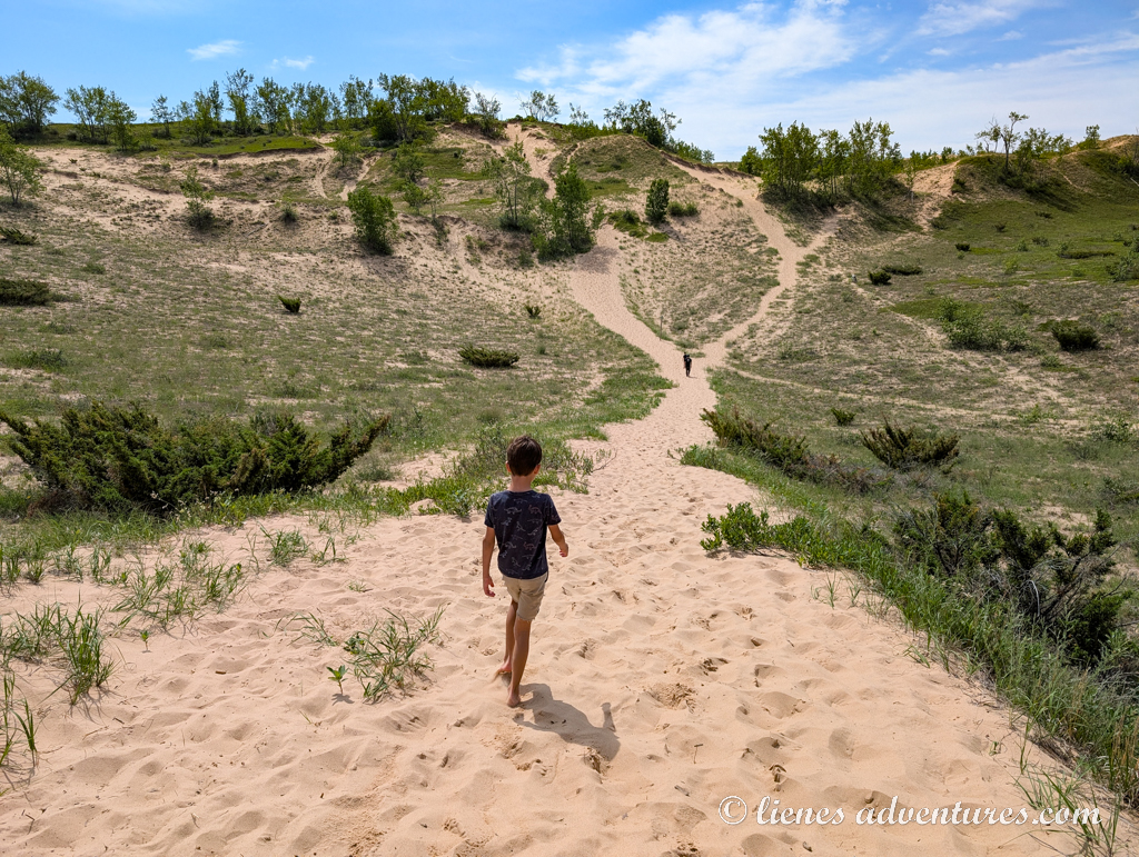
Most of the time, people just climb the dune right here by the parking lot and don’t venture much farther. However, a 4-mile (6.5km) round trip takes visitors to the shores of Lake Michigan. While initially I did not plan on going all the way to the lake, the legs just kept taking us forward and forward… And another visitor told everyone around that there was a big sand dune at the end. Really? How did I miss that piece of information? We had to see it, so we pressed on…
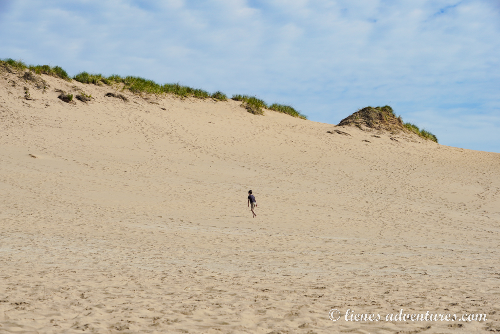
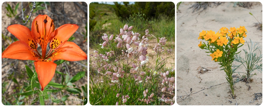
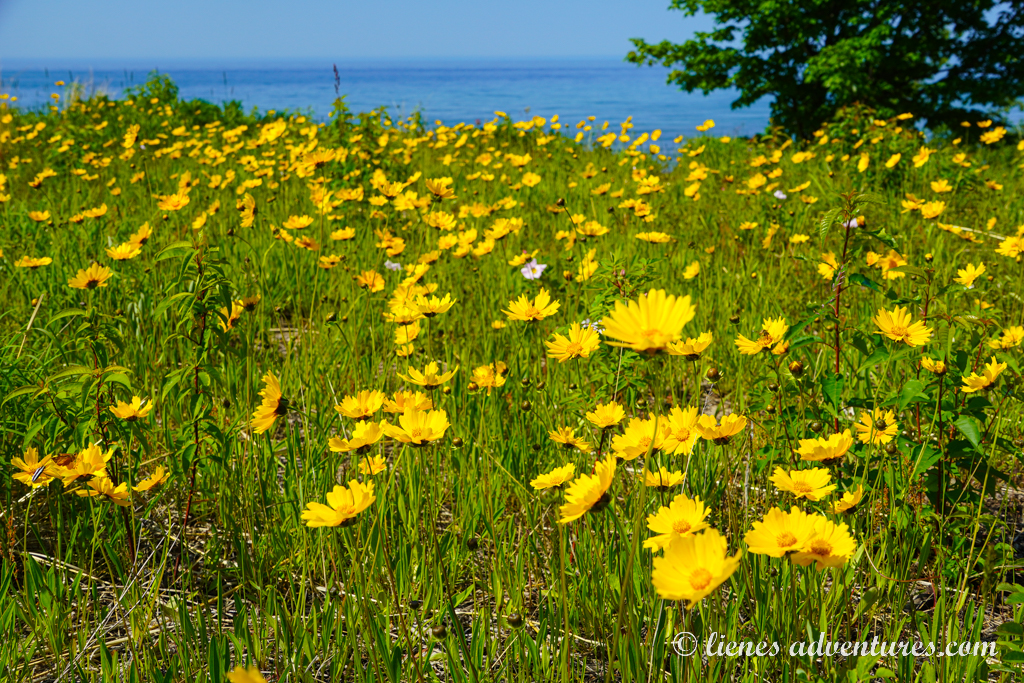
But there was no dune – he had mixed up his information and had told everyone some wrong intel. Which was a little bit funny to see, when this person showed up at a lakeshore to see no tall dunes in sight… He felt bad for everyone he had unintentionally lied to. Nevertheless, the hike, although extremely hard, was very interesting. I loved seeing the various wildflowers blooming and showing their colors in this dry sand environment.
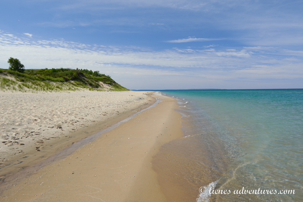
And the lakeshore was beautiful with crystal-clear, ice-cold water. Apart from the grassy, rolling dunes, the turquoise water along the shoreline rivaled some of the beaches of the Caribbean Sea.
While my husband and I sat down for a little break, the boys continued their search for Petoskey Stones. And this time they actually found one! They were super excited!
As it was still barely noon by the time we got back to the parking lot, and still sunny outside, we wanted to use our time productively. Another place on my list to see was the town of Leland. It was a preserved, historic fishing village about half an hour’s drive away from the Sleeping Bear Dunes. Besides, it would be a great spot to grab some local lunch as well!
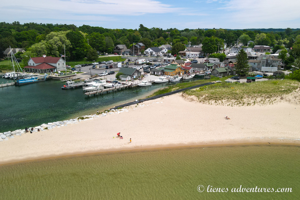
Unfortunately, this was one of those places that might not have been worth the drive. Although pretty, the whole “historic fishtown” consisted of just a handful of building on the right and left side of Leland River. That was all. It was great for a single photo, but there was nothing much more to it – you could walk the whole place in about 2 minutes.
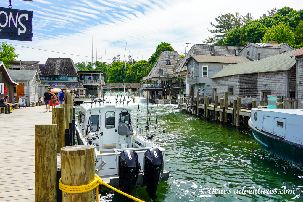
And all the buildings were turned into commercial establishments – cafes, restaurants and souvenir shops. We sat down for (an expensive, tourist-priced) lunch and grabbed some ice cream to go for dessert.
Without much else to see or do, we were soon back in the RV making our way back to the park. With the extra time and still no rain, I talked my men into one last hike of the day – the 2-mile (3.2km) long Empire Bluff Trail. It promised some great views of the lakeshore. Although slightly unwillingly, they obliged for one last evening hike. It was a simple wooded trail leading to a boardwalk with an overlook platform of the lake.
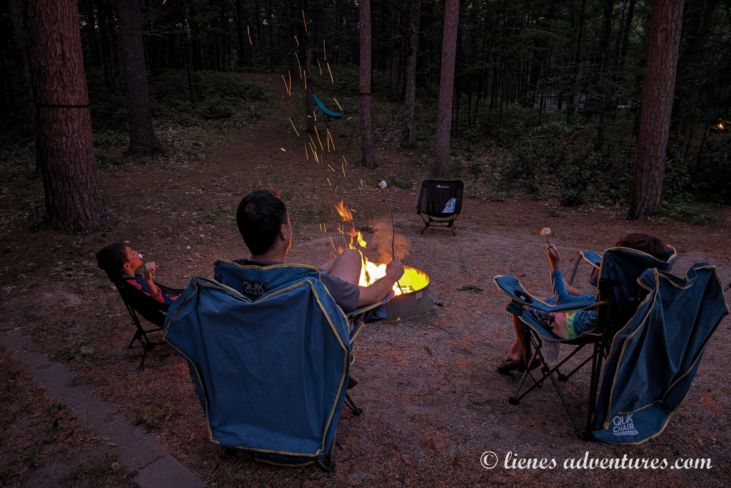
We sat there for a little while taking in the (cloudy) views and then turned around to make our way back to the campground. The kids had lots of fun lighting the campfire and roasting some smores. It was a nice end to a busy, long day.
Thu, June 26
We woke up in the morning to rain patter outside our windows. The weather forecast wasn’t going to give us any good news either – it showed rain and more rain for the rest of the day. While we had planned for a day of bike riding around the park’s bike trails, that did not seem like a good idea at this point. And there was nothing else to do. So, we decided to move our itinerary up by a day. I called our campground in MacKinaw City to see if they might have a campsite available for us a day early. And they did! This meant we were bidding farewell to Sleeping Bear Dunes National Lakeshore.
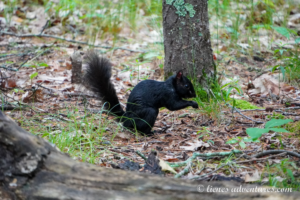
While my husband and kids were preparing the RV for departure, I walked out with my camera in hand. I was hoping to catch a photo of the elusive black squirrels I had seen running around the campground the last few days. They were quite fearful and quickly disappeared when people came around. The dark woods, misty weather and overcast skies did not provide the best conditions for wildlife photography, nonetheless, I somewhat succeeded!
Before leaving the park altogether, we made one last stop – the Visitor Center. The boys turned in their Junior Ranger booklets and received 3 badges: the Great Lakes badge, the Sleeping Bear Dunes badge, and Wildfire Safety badge. Afterwards, we walked through the exhibit and sat down to watch a park movie.
With this, our time at Sleeping Bear Dunes National Lakeshore had come to an end.
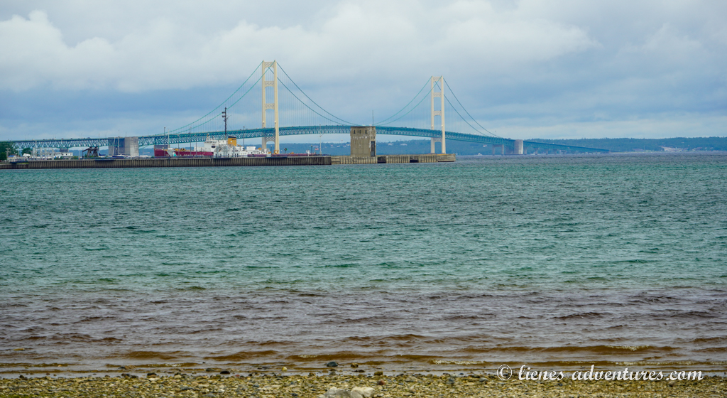
MACKINAC ISLAND
We had a rainy 3-hour drive to our next campground in MacKinaw City in the northern part of the peninsula. Although we had a beautiful campsite on the shore of Lake Huron, there was not much we could enjoy this evening. It was very windy, rainy and cold, barely reaching 60 (+15C) degrees. So, the time was spent inside the RV, playing board games and watching movies. And the view outside our windows was as beautiful as ever - rain or not.
Fri, June 27
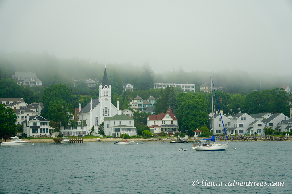
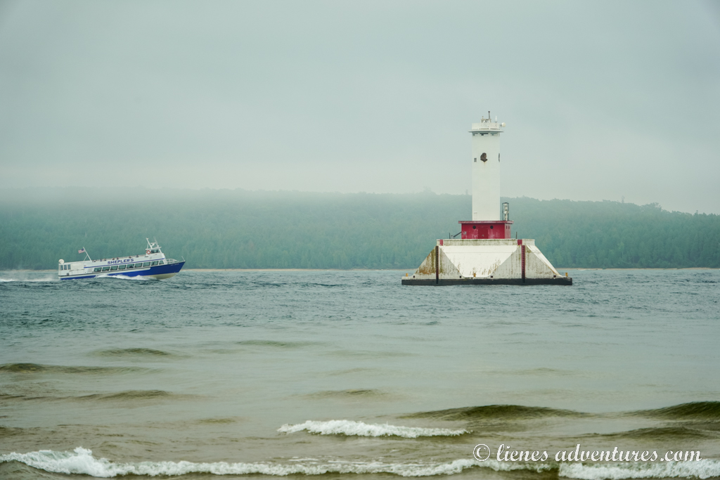
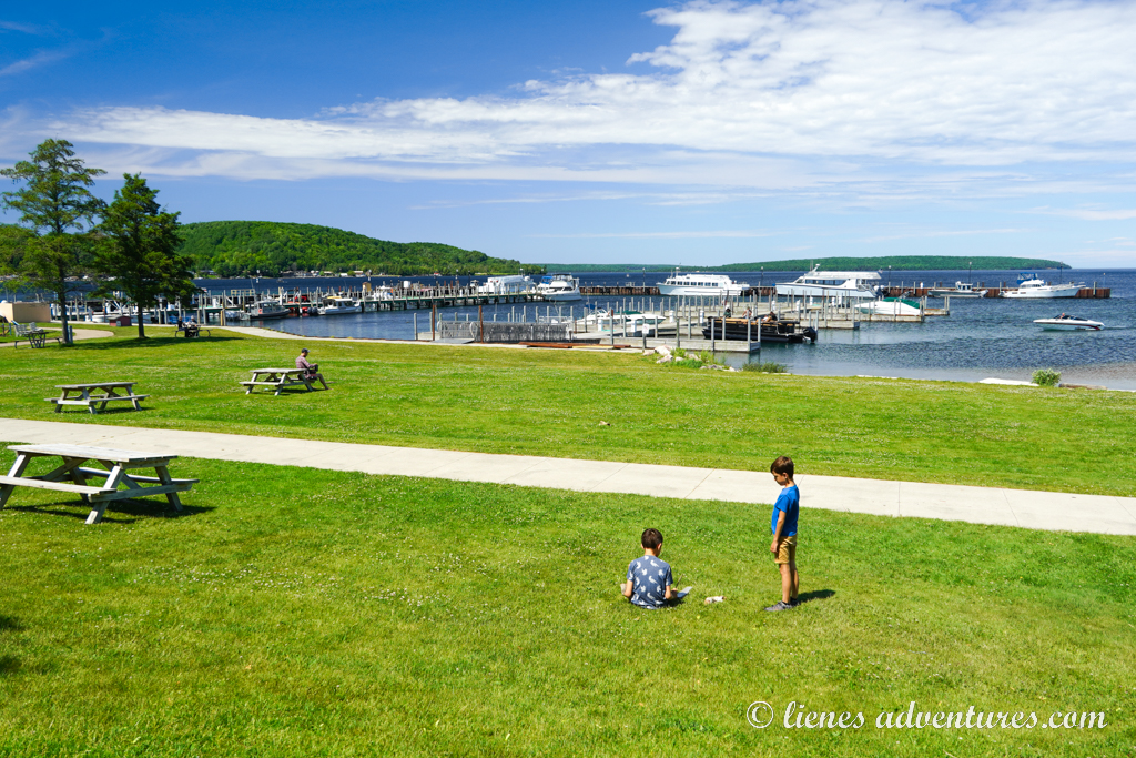
Today I had planned to spend a whole day on Mackinac Island. The weather still wasn’t what we would have hoped for, but this was our only chance to visit the island as we had to leave the next day. We packed our rain gear, hopped on our bikes and took the trail into town, all the way to the ferry terminal. Mackinac Island was a unique spot where no cars, golf carts or any other gas or electric powered vehicles were allowed. There was no bridge to the island, so the only way to get there was by a ferry which carried both – passengers and their bikes. Along the short 10-minute ferry ride, we witnessed several lighthouses and watched the fog and cloud engulfed island get closer and closer.
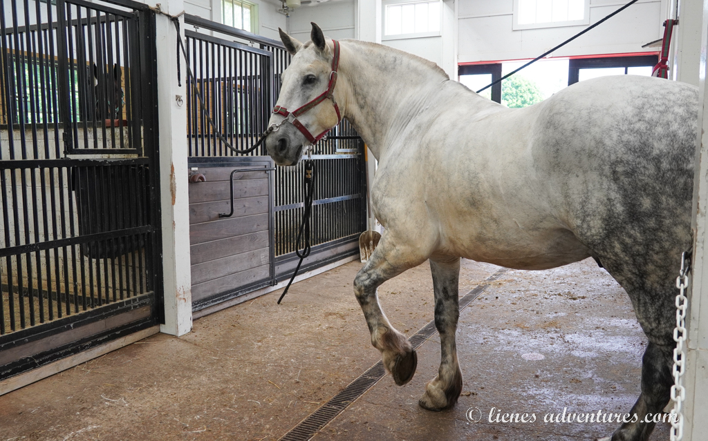
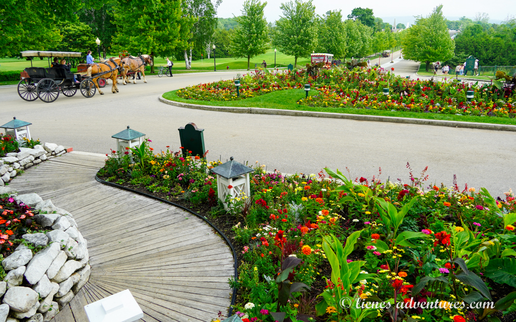
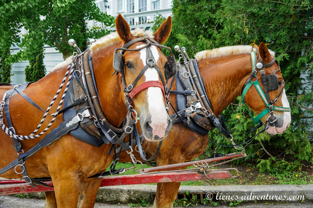
Once we stepped our foot on Mackinac, we were surrounded by bikes and horses. Horses everywhere! Horses were used to carry around passengers. There were horse drawn carriage tours offered around the island.
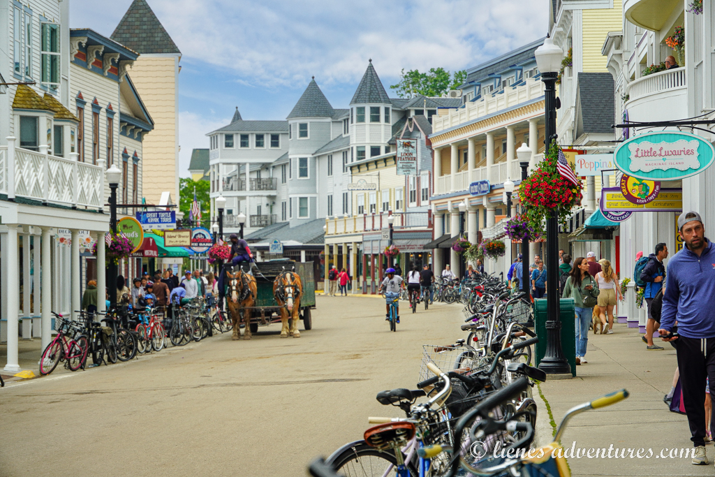
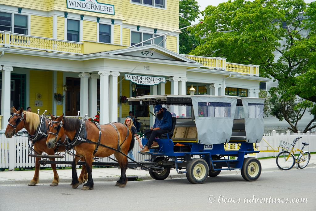
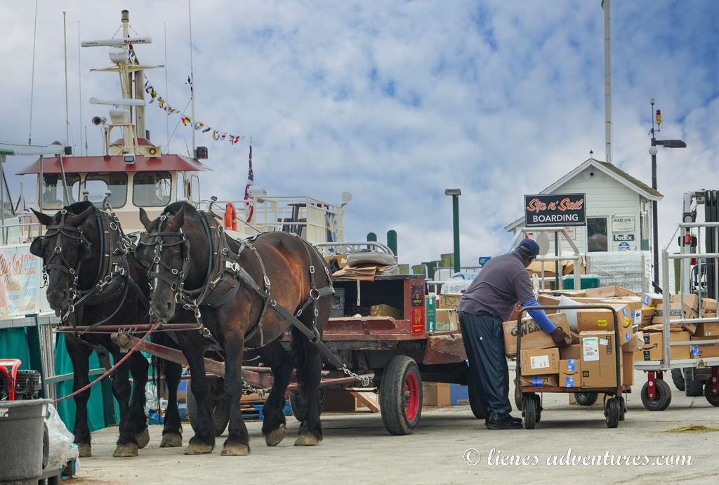
But with no vehicles available, horses also had a more practical use. Some of the big horse-pulled carts were used as garbage dump trucks. And flatbed carts were lined along the shipping dock with horses waiting for Amazon boxes, USPS shipments, letters and packages being unloaded from the ferries, put into the carriages and then distributed around the island.
It was such a surreal atmosphere, and we loved it!
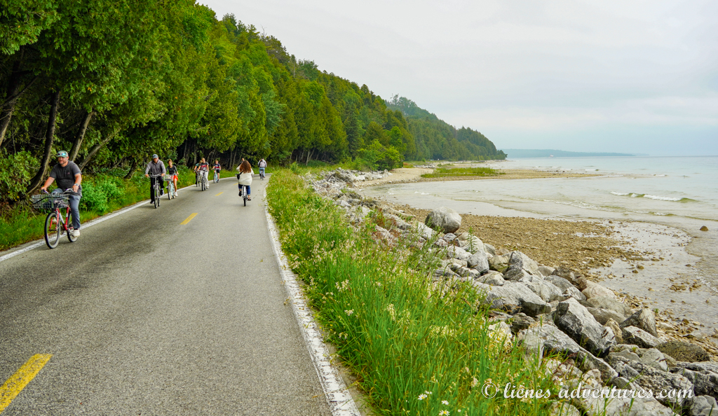
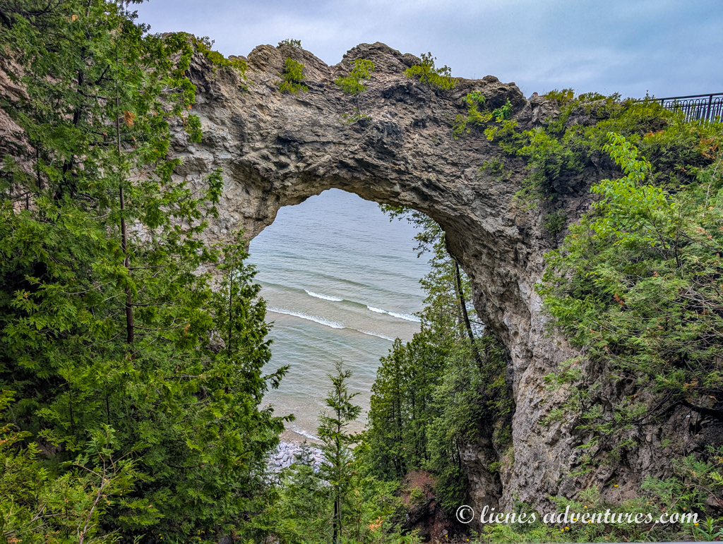
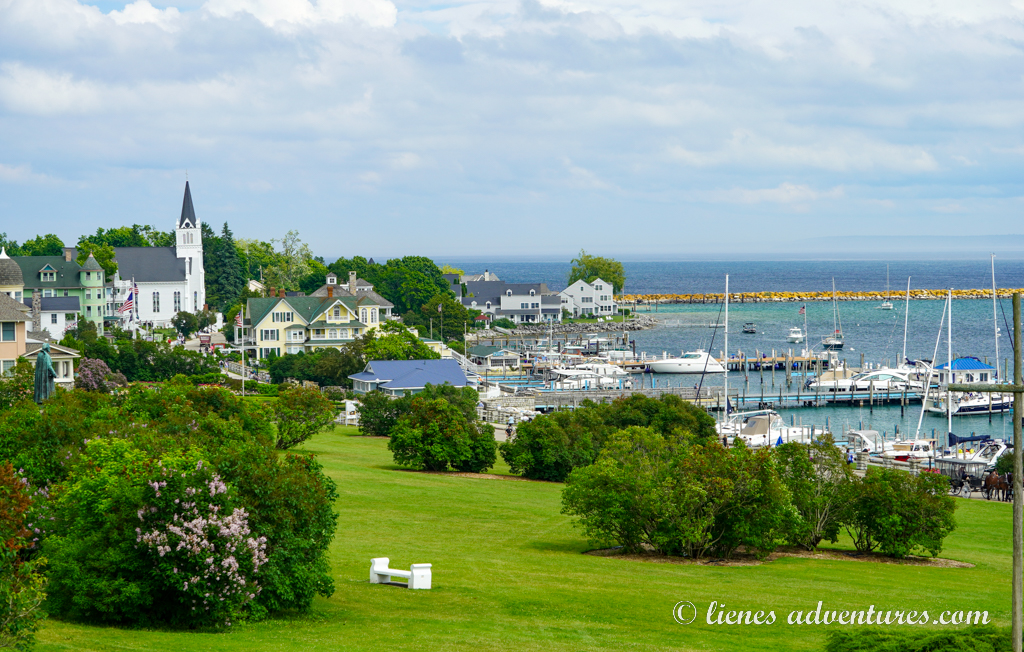
The most popular thing to do on Mackinac, was to walk or bike the 8-mile (13km) long loop road around the island. The road was flat, beautiful and void of cars! Although it was extremely overcast and foggy, and we did not quite get to witness the full spectrum of the colors of the lake, it was still quite spectacular.
We made many stops along the way, including the famous Arch Rock.
The weather was quite a tease, and we never knew what it would be like 5 minutes later. It could be completely dreadful, black skies, only to turn almost blue and sunny 10 minutes later. And then suddenly it started raining out of nowhere! It sure was an adventure into the unknown.
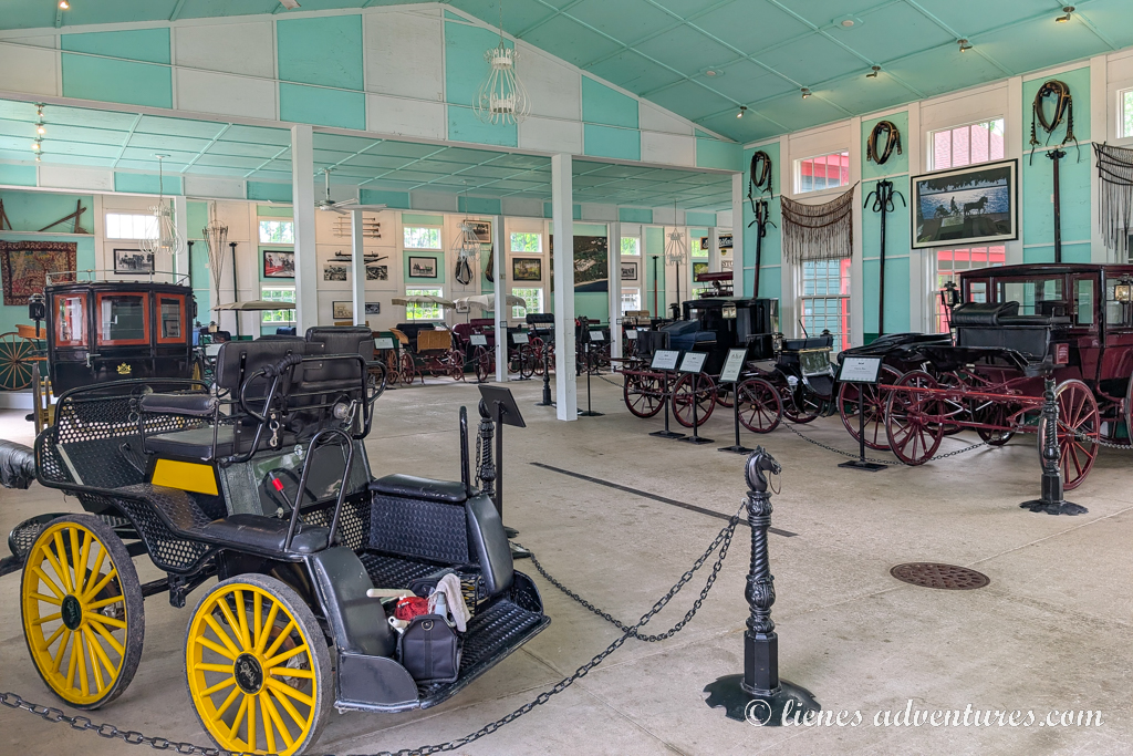
To explore the hilly interior of the island and town, we parked our bikes and walked uphill towards Mackinac Island Carriage Tours Grand Hotel.
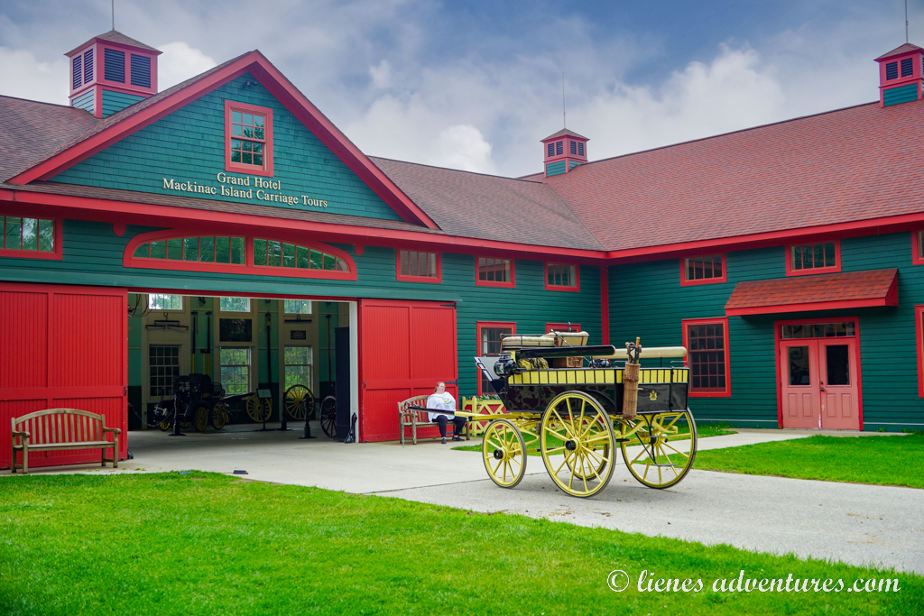
This was where some of the carriage horses were stabled, and we got to see them up close. There was also a very nice exhibit showcasing various carriages from back in the day.
Afterwards, we just wandered around town, looking at the architecture, beautiful gardens, parks, and stunning vistas that came into view.
There were very many stores offering various delicious island treats. The boys were eyeing caramel covered apples, so we made a deal – if we got in extra exercise and went on a bike ride around the island one more time, we would get them each caramel apples! They agreed, and off we went – on another 8-mile (13km) ride. This was a beautiful island, and we (obviously) did not want to leave.
Unexpectedly, Mackinac Island had become one of the most memorable places we saw during this trip. We had crisscrossed the island several times, walked and biked it, had seen its sights, petted plenty of horses, and eaten our fair share of sweets and treats… Inevitably, the evening was approaching, and it was time to catch our return ferry back to the city.
Back at the campground, the weather was still windy and chilly, so we enjoyed one last look over Lake Huron before settling in for the night.
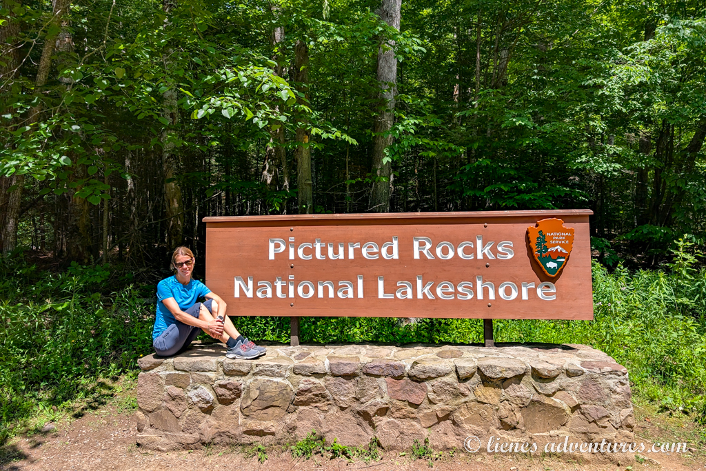
PICTURED ROCKS NATIONAL LAKESHORE
Sat, June 28
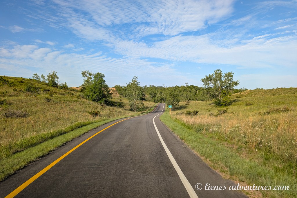
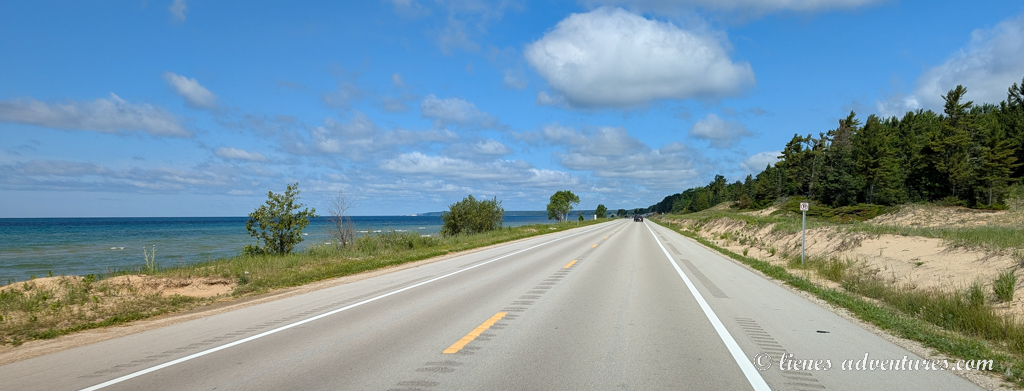
New day, new adventures! And thankfully, it also looked like the stormy weather of the past few days was finally letting up. We packed up the RV and pulled out towards our next big destination of the trip – Pictured Rocks National Lakeshore. The road-side scenery on this road trip was overall quite simple – flat and wooded throughout with occasional marshes and lakes peeking through the trees.
With Pictured Rocks being quite spread out, we opted to explore the eastern part of the park on this day (as that was the direction we were driving in from).
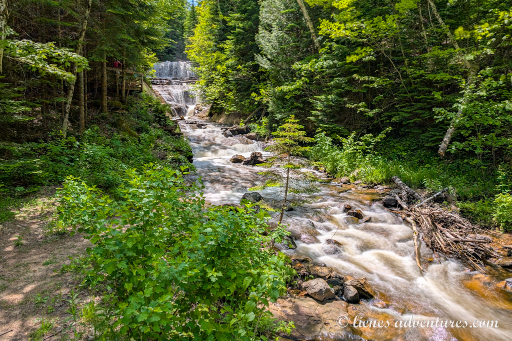
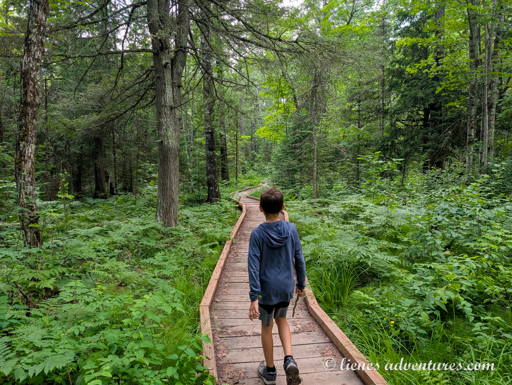
Our first stop was a short walk to Sable Falls Overlook via a wooden boardwalk. It was an alright spot to stretch our legs, but nothing impressive, so we soon moved on.
A quick drive from Sable Falls was another popular spot, easily reachable on a 0.5-mile (0.8km) short trail, - the Log Slide Overlook. The storm clouds of the past two days had moved on and we had beautiful blue skies above us. That, in return, illuminated the lake in its many shades of blues and greens. The steep, white sand bank gave it a little bit of an other-worldly appearance, and we loved it!
The boys asked if they could go roll down a sand hill… I think had we said “Go ahead!” they would not have hesitated. Makes me wonder, really, at what age does self-preservation start coming into play?
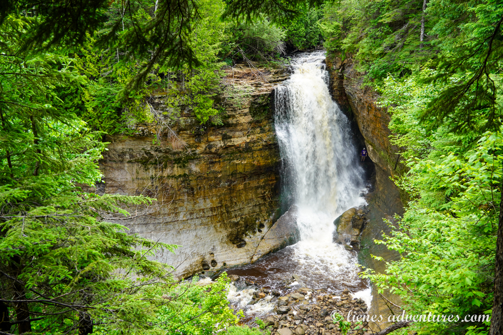
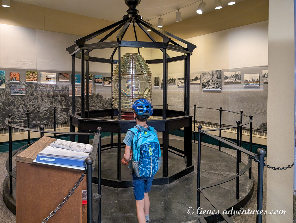
Our last, big hike of the day was to AuSable Light Station. A 4-mile (6.5km) round trip trail took us along the shores of Lake Superior towards a historic lighthouse. It opened in 1874 and guided ships around the lake’s shallow Sable Point until 1910.
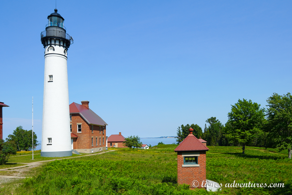
While it was worth the hike just to see the lighthouse from the outside, we discovered that park service employees were giving free guided tours of the lighthouse a few times per day. And we just happened to arrive for the last tour of the day and still have 4 spots available for us! That was lucky and we were very excited.
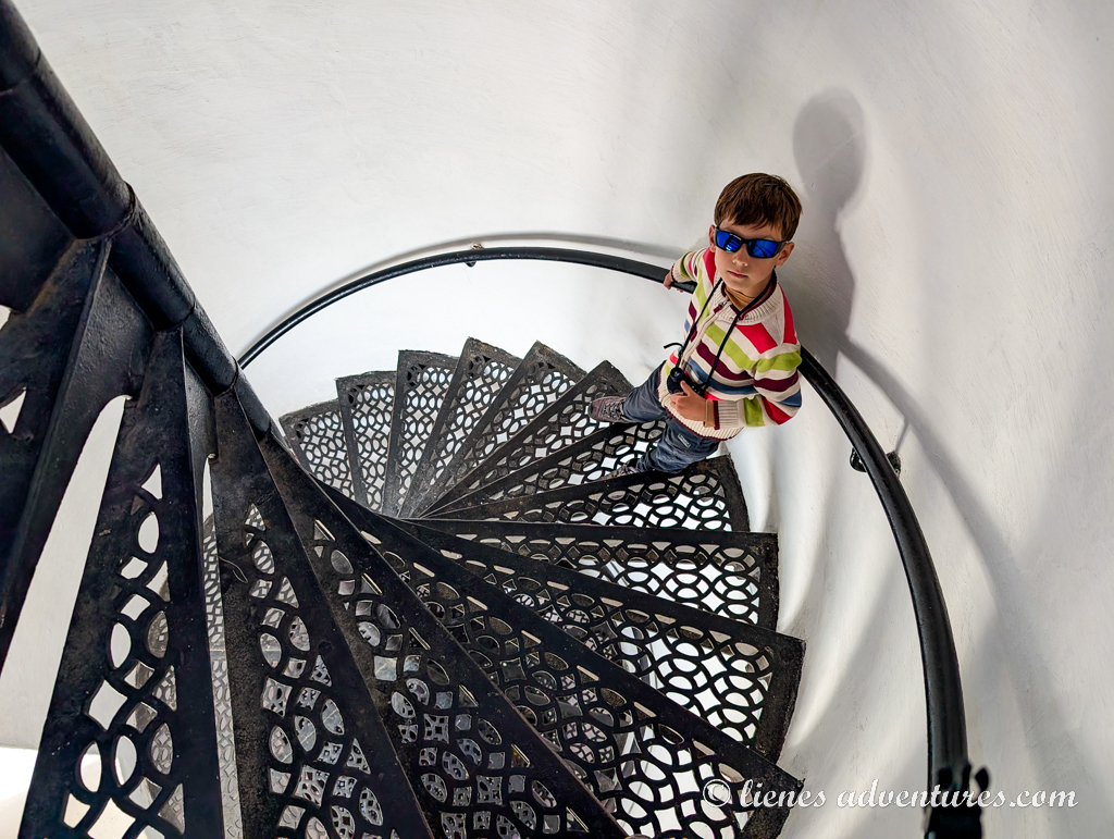
The tour started with a brief history of the lighthouse and some stories about the lighthouse keepers and their daily life here. There were also interesting facts about the lake and the many ships that sank or ran ashore here. Afterwards, our group was handed off to a different ranger who took us all the way up to the top of the lighthouse. From here we could see to the horizon across Lake Superior. We also noticed the Log Slide Overlook area where we were just a few hours earlier.
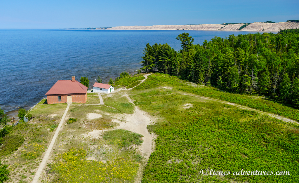
Interestingly, the lighthouse is still in use today, but it is now automated and manned remotely – no lighthouse keepers needed on site anymore.
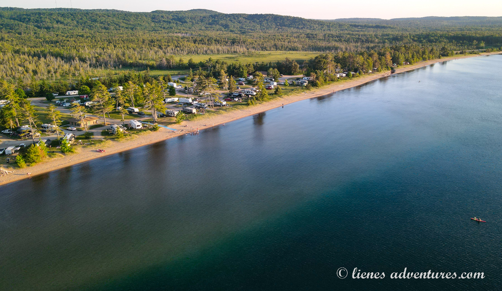
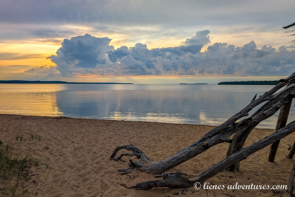
This had been quite a long day, so we decided to not make any more stops but drive straight to the campground to have a leisurely, relaxed evening. When booking the campground, I had read that it was on a lakeshore. What I did not realize was just how nice the beach was here! Before we even managed to settle into our campsite, the boys jumped on their bikes and zoomed off to the beach. The rule was though, that they were not allowed into the water until mom or dad was present.
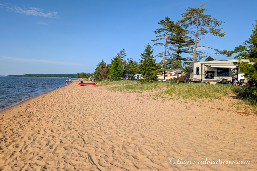
After my husband and I had set up our RV at the campsite, we walked down to the beach area and the boys were finally allowed to swim. I have no idea how they did it, because my ankles were freezing just from wading in the water for a few minutes. The lake was extremely cold! Although it looked inviting, the average surface temperature for Lake Superior during the summer months was only around 52.5°F (11.4°C). If one happened to fall in this water and needed rescue, the expected survival time would be only 1-6 hours before hypothermia and unconsciousness set in.
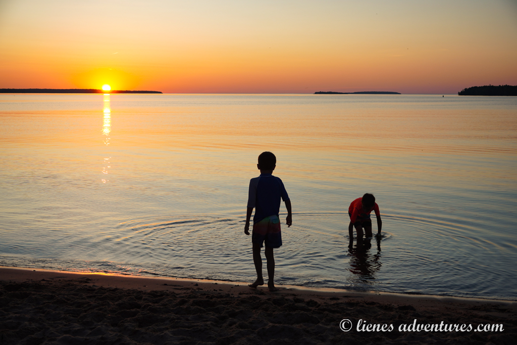
As it approached 9PM, more and more people gathered on the beach to watch the sunset. Not only was this a great spot for camping and swimming, but this was also a great location to watch the sun slowly slip under the water’s edge.
The cold water had totally hyped up the kids, and now they requested an evening campfire to warm up and some marshmallows to restore their lost energy reserves. Not that they ever lacked energy… but a campfire and marshmallows were a nice way to conclude the night.
Sun, June 29
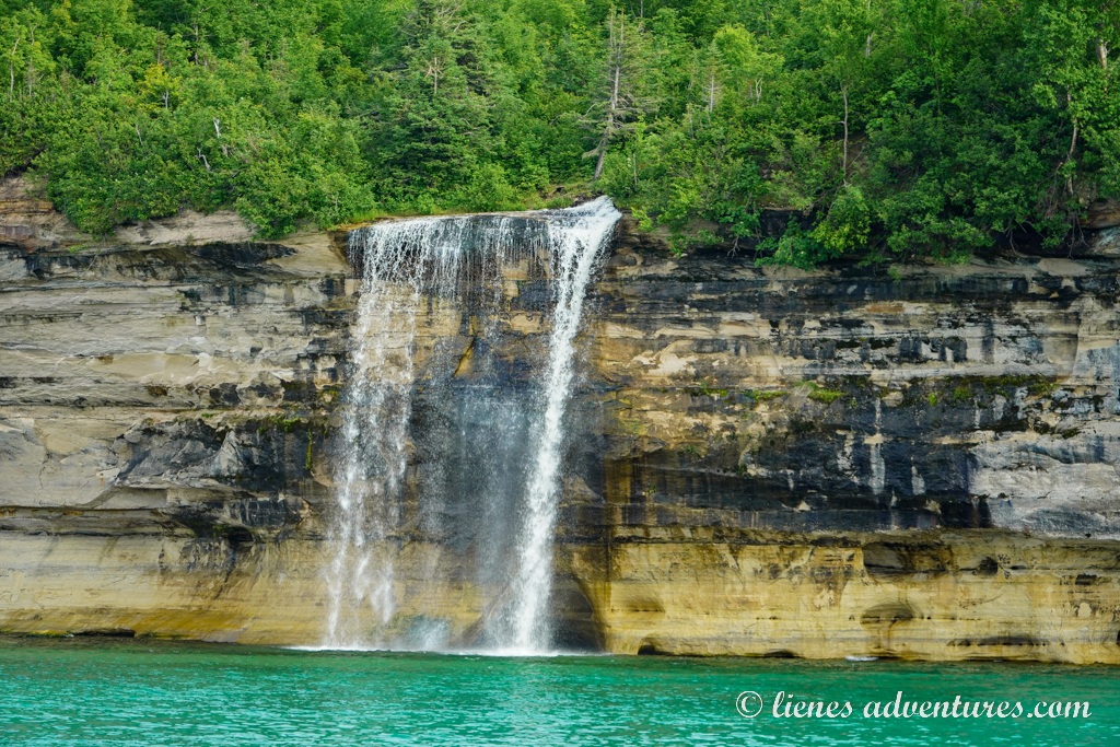
Today was another day we were spending at Pictured Rocks National Lakeshore. An important thing to note about this park was that most of the beauty of it could only be seen from a boat. Therefore, we had a very special event planned – a boat tour to go out and see the rock formations. However, as our tour was later in the evening, we had a few hours to spare in the morning.
With the extra time at our disposal, we headed out to explore the 1.5-mile (2.5km) long Miners Falls Trail. The fast-flowing Miners River dropped about 50 feet (15m) over a sandstone outcrop, creating the park's most powerful waterfall. It was obvious that this was one of the park’s more popular trails – we had to wait in line at the overlook just to take photos of the waterfall.
Several daredevils had also climbed over the railing and made their way down the steep, slippery bank to reach the bottom of the falls. Definitely not something we planned on doing, although our boys seemed very keen on trying... The adults down there were setting a bad example.
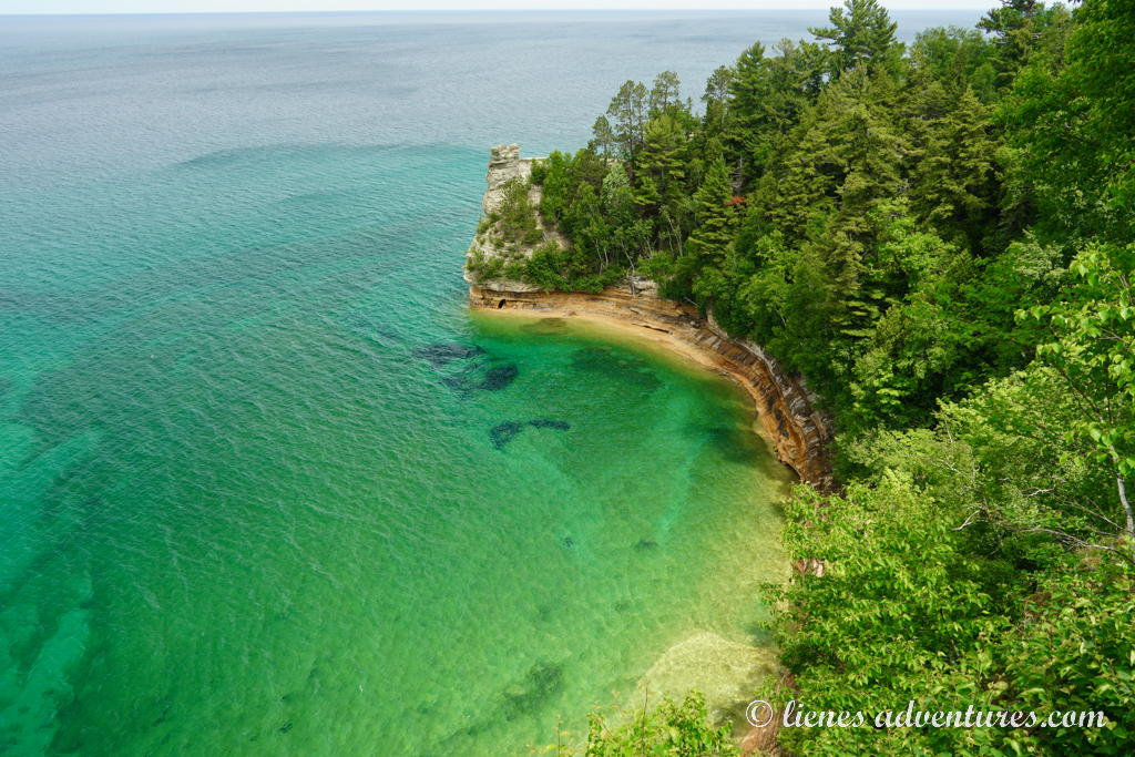
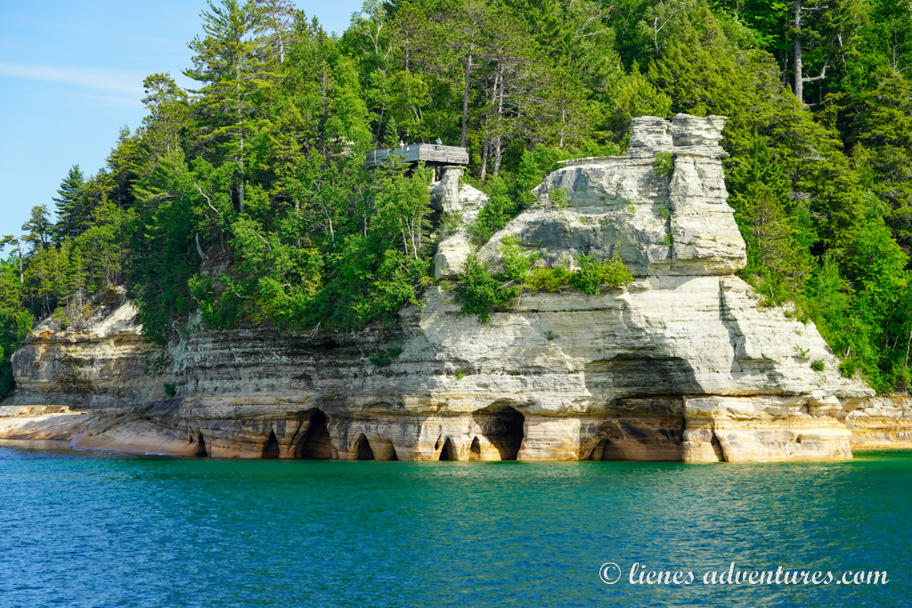
After completing our own little photo session, we walked back to the parking lot to drive to our next stop – Miners Castle Trail. There was, however, no castle to be seen there, rather a rock formation created by erosion over long periods of time. Maybe it looked a little like a castle tower overlooking the lake? It was a beautiful overlook with all the lake’s magical colors showing off in the sunlight.
As it was approaching early afternoon, we opted to stay close to the town of Munising where our boat tour was departing from. We found a great parking spot right next to the harbor and went to explore the town.
We walked into the visitor center and watched a movie about the area. And we got some iced coffee and ice cream to cool off on this unusually hot day at the Upper Peninsula.
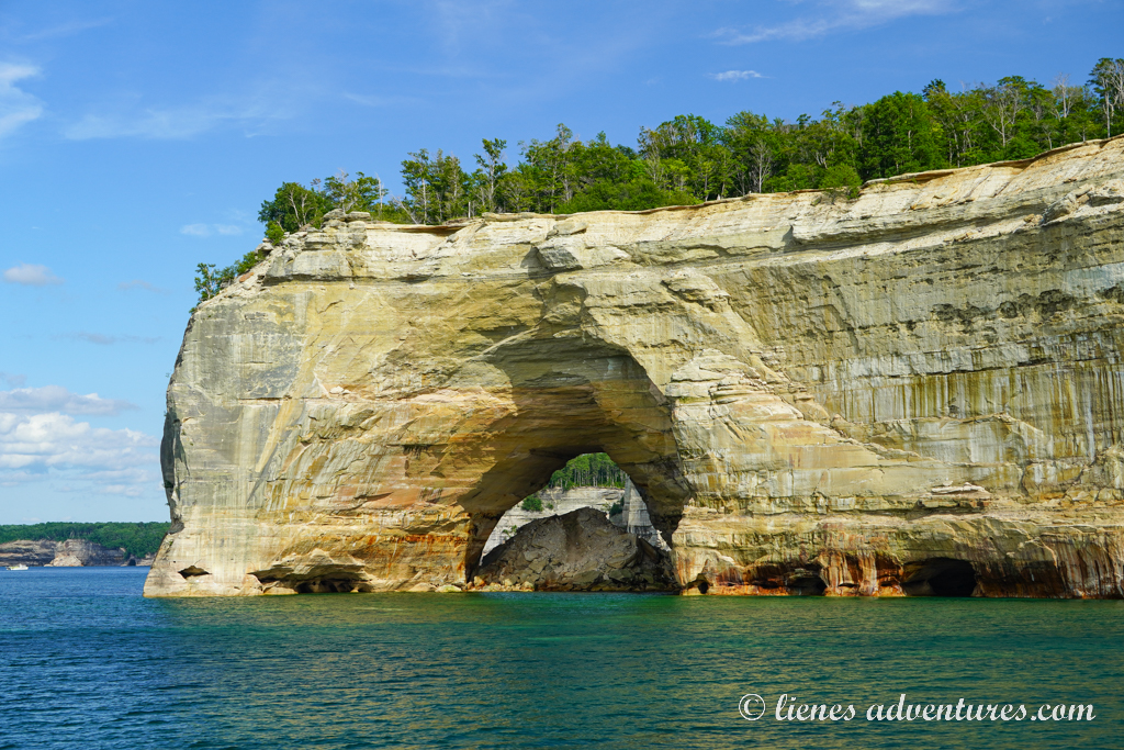
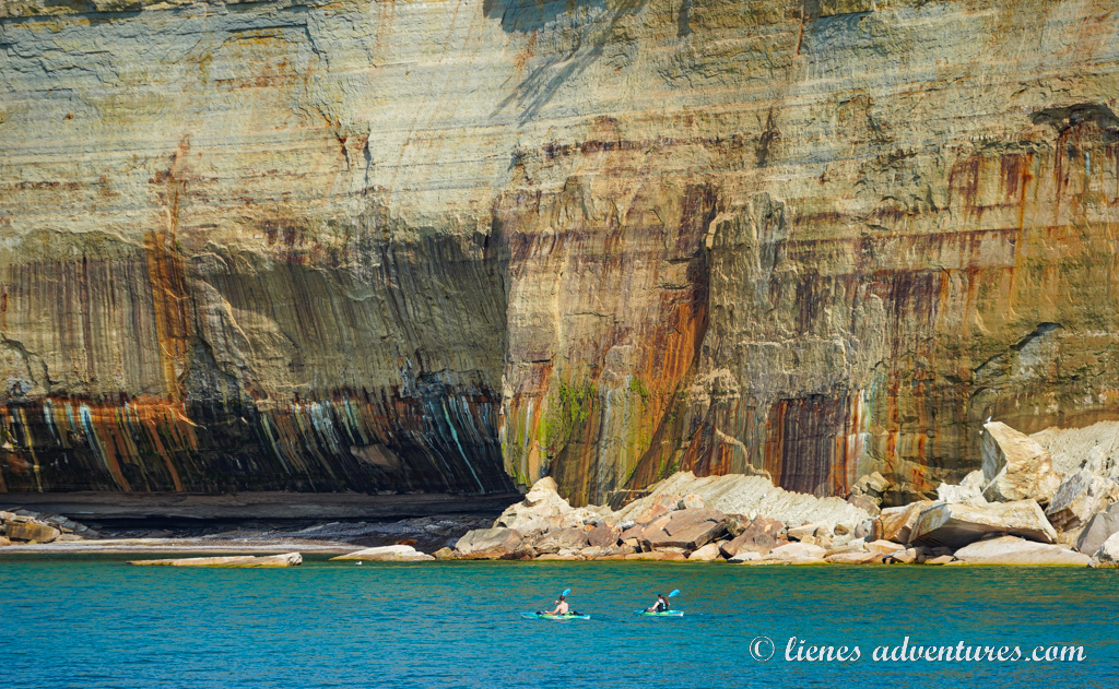
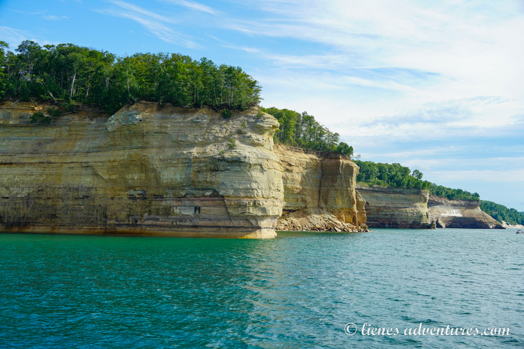
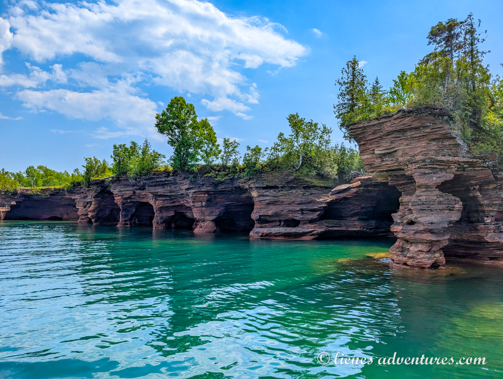
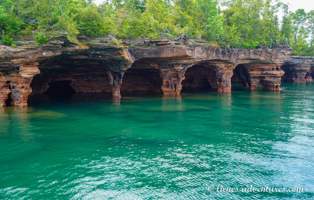
Right before 5PM we lined up for our “Spray Falls” cruise. As most of the park’s formations couldn’t be seen from shore overlooks, taking a boat or kayak tour was the only way to see the sandstone cliffs, sea caves, pillars, arches and even waterfalls.
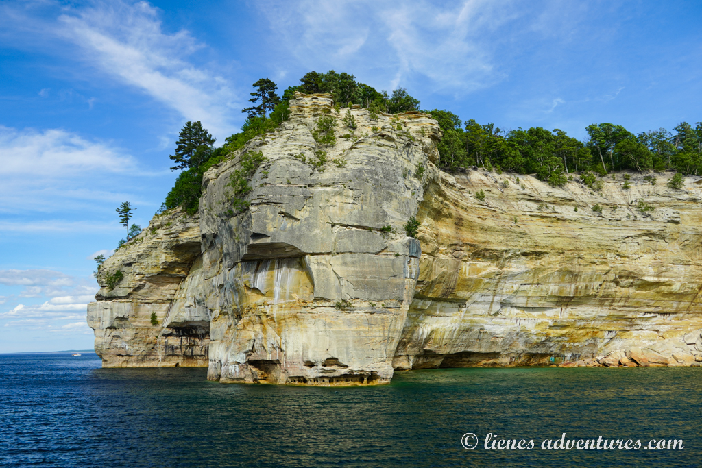
The amount of geological diversity was astounding! We saw tall cliffsides with sea caves of various sizes at the water’s edge.
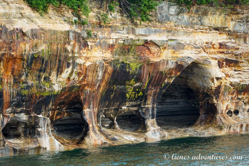
There were also a few large arches with water too shallow for our boat to go through, yet it was a favorite spot for kayakers.
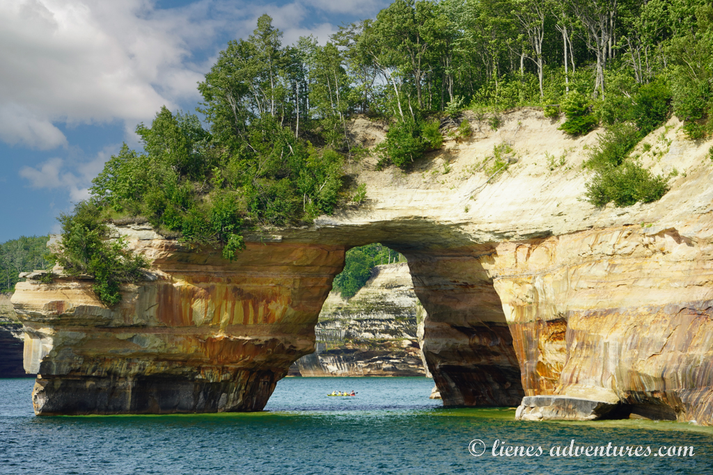
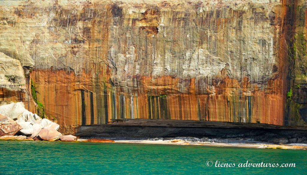
But the most impressive section of them all was the Colored Walls. They were formed primarily due to mineral staining on the sandstone cliffs. Groundwater seeping through the rock face carried minerals like iron, copper, manganese, and limonite, which oxidized and deposited colorful streaks as the water trickled down. Iron produced red and orange, copper created blue and green, manganese resulted in brown and black, and limonite yielded white stains.
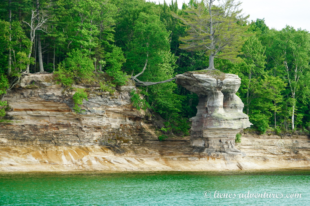
The boat captain also made a stop near the ‘Lone Pine’. Estimated to be around 250 years old, it was truly a resilient tree. The rock once had a natural archway connecting it to the mainland, but it collapsed in the 1940s — leaving the tree stranded on its pedestal with roots stretched across the void in search of nutrition.
Our turnaround point was Spray Falls.
Overall, the tour took about 2 hours and was definitely worth the cost to get a better impression of what Pictured Rocks National Lakeshore was all about, and all the special treasures it protected within its boundaries.
After the boat tour, we returned to the campground to let the boys play on the lakeshore again. I think this was their favorite campground of the whole trip! And it was another beautiful sunset and a great way to end our time at Pictured Rocks.
Mon, June 30
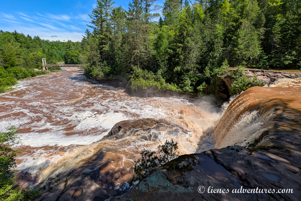
Today was a relatively long drive to our next destination – a 250-mile (400km) / 5-hour drive to reach the Apostle Islands. To split up the long hours on the road, half-way through I had made note of a hike that I was interested in. The weather seemed to be holding out, so we decided to make the short side-trip. Luckily for us, although the wooded gravel parking lot could fit only a handful of cars, there was just 1 car there when we arrived. That meant we could successfully fit our RV at the trailhead. I am not sure my kids were equally excited about the available parking… They were probably hoping it would be full.
O Kun de Kun Falls trail was a 3-mile (5km) round trip hike that led to a waterfall. From the recent storms, the water level at the falls and river was very high. And from lots of beat-up sediment and erosion, the water was churning dark brown. Definitely not a good place to slip on a rock and fall in.
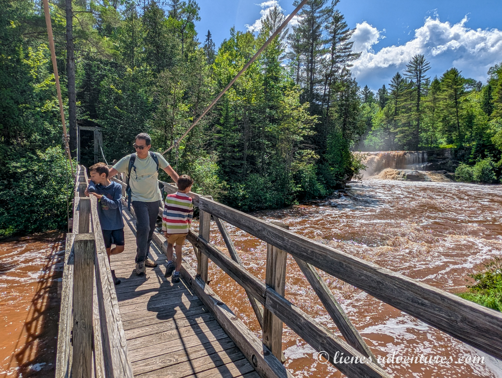
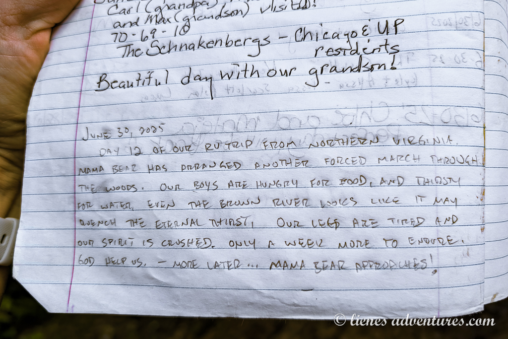
While I was exploring the best spots for picture taking, my husband and kids were keeping themselves busy by the trail’s mailbox. What was so interesting there? Apparently, they were leaving a note of their own in the trail journal…
On our hike back, the clouds gathered, and we started hearing thunder in the distance. As we made it back to the RV, it started pouring. Right on time!
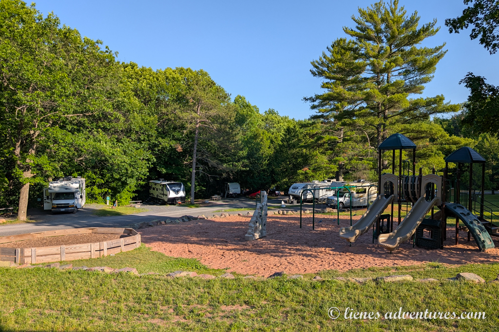
The rest of the drive was spent fighting our way through spotty, heavy downpours until we reached the campground in Bayfield. The rain had stopped, so the boys spent the evening at the playground.
And as far as me - it was laundry time again! And this time I came prepared with all the coins required!
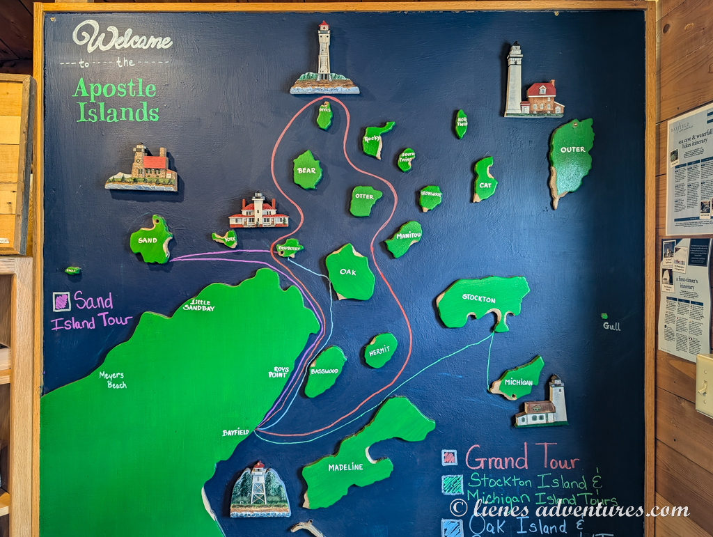
APOSTLE ISLANDS NATIONAL LAKESHORE
Tue, July 1
Today was another boat tour day. Unlike Pictured Rocks, Apostle Islands National Lakeshore did not have any big landmarks or impressive trails that could be explored from land here. The only meaningful way to see the islands was by heading onto the lake via tour boat.
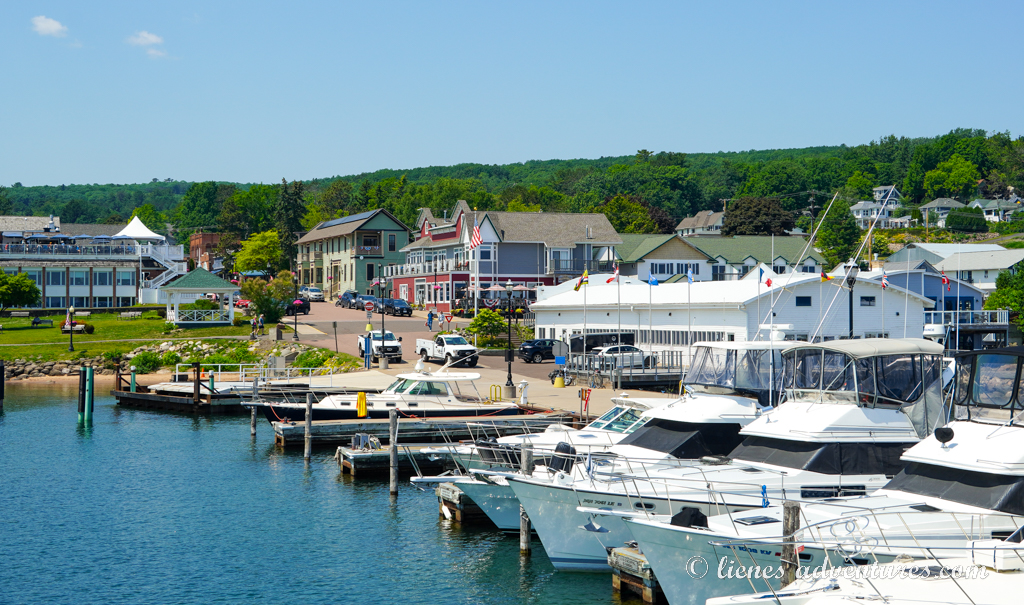
We biked into town and down to the harbor. I had already made tour reservations several months prior, and that was a good call – the tour was sold out. I had booked the “Grand Tour” which did not make any stops on the islands yet covered over 40 nautical miles (75km) over the water to give a bigger overall picture about the area.
To get the best spot on the boat, we lined up on the docks 40 minutes before the tour start time. Unfortunately, we also witnessed an older gentleman who started feeling not so great standing in the hot sun and fainted. Bystanders helped him out with cold water and umbrellas to keep him in the shade. An ambulance was called, however, to take him to a hospital for an evaluation just as a precaution.
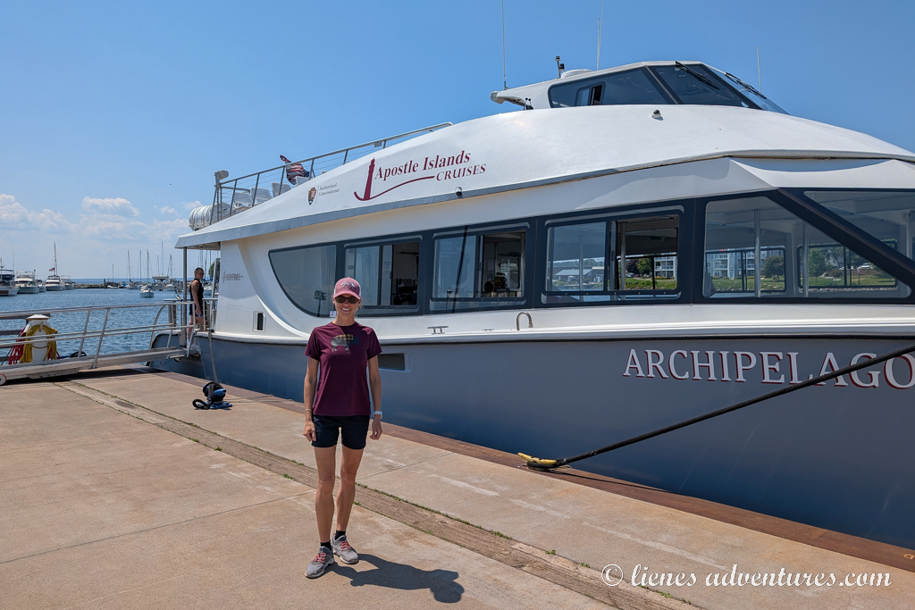
Once the big commotion was over, the boat was finally open for boarding. From the top deck I had a great view back across the harbor and of the town.
Apostle Islands National Lakeshore features 21 islands, many of which we would be able to see when passing by. The National Park Service also allows drop-off camping and hiking at several of the islands if one wanted to do that. For us, just seeing the overall picture of this area was good enough for a first-time visit.
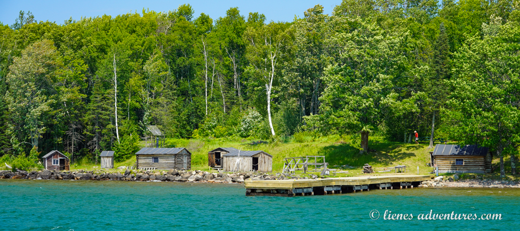
The first sightseeing spot on the tour was the restored historic Manitou Fish Camp. The camp as we saw it was built in the 1930s as a winter fishing camp. The ice here grew thick enough for winter shore fishing and fishermen needed a place to stay. For three decades, this ramshackle camp became a favorite destination for many local men. Nowadays, the camp is part of the national park system and occasional tours are offered here.
Our next unexpected stop was a pair of bald eagles perched up in a tree near their nest. We had seen many bald eagles in Alaska, but it was very special here to see a nesting pair next to each other.

The most impressive island of the tour was the Devils Island and its distinctly red sea caves. Although we were not there during the best lighting conditions (late afternoon tours are best for deep colors), it was still beautiful.
The boat captain made several passes here so all the visitors could see the caves from all directions.
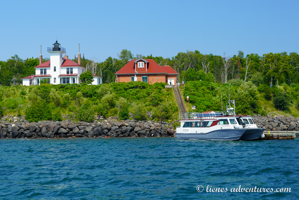
Raspberry Island lighthouse was the last sightseeing stop of the cruise. Again, we did not get off the boat here as it was not part of our itinerary. However, Raspberry Island lighthouse tours were offered as a separate package and were said to be very interesting and educational. One such tour boat had docked there right as we were passing by.
Overall, this Apostle Islands tour was more interesting and educational than I expected it to be. I had read some reviews that it was boring, and all the islands looked the same… I guess our captain knew how to entertain us with his stories and kept us busy in between the sightseeing. I would not call this tour boring by any means! Maybe not quite as impressive and saturated as the Pictured Rocks boat cruise, but Apostle Islands had a charm of their own.
After the tour, we hopped back on the bikes and made our way to the Apostle Islands Visitor Center where we watched a park movie, and our kids received their Junior Ranger badges. The exhibit and gift shop were neat too.
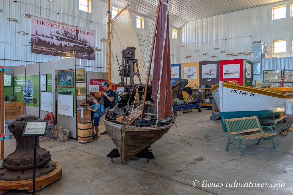
Based on our boat tour captain’s suggestion, we stopped at the Bayfield Maritime Museum. Exhibits here told stories and contained artifacts about Lake Superior commercial fishing, lighthouses, boats, ships, and the people of Bayfield who made their living on the lake.
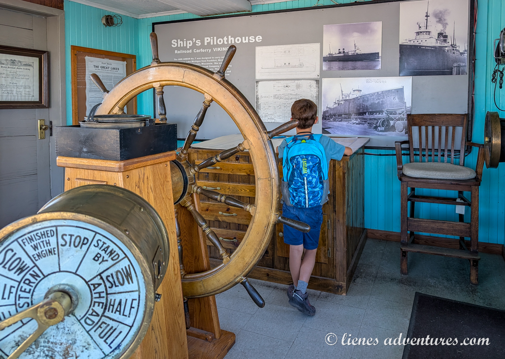
The boys loved it here, as they got to do a scavenger hunt game around the museum. After the task was successfully completed, they got rewarded with a local author’s book “The Adventures of a Lighthouse Keeper’s Daughter”. They read the book in one day and said it was very interesting. Apart from an interesting storyline, it also gave them a good insight into the area’s history.
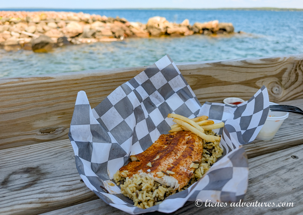
One last task of the day was to finally get a good local dinner. Again, listening to our tour boat captain’s suggestion, we went to Hoop’s Fish and Chips. It was an outdoors style grab-and-go restaurant that offered fresh, daily caught whitefish with either a side of rice or fries. And, I guess, when you only serve one thing, it is executed perfectly. And that was indeed the case! My husband doesn’t even particularly like fish, but even he said it was delicious. And the view of the lake was just an added bonus!
The 3-mile (5km) bike ride back to the campground was a lot more difficult than riding into town in the morning. That might have been either because we were just too full of tasty whitefish…. or because the road back was all uphill. I suspect it was probably the latter.
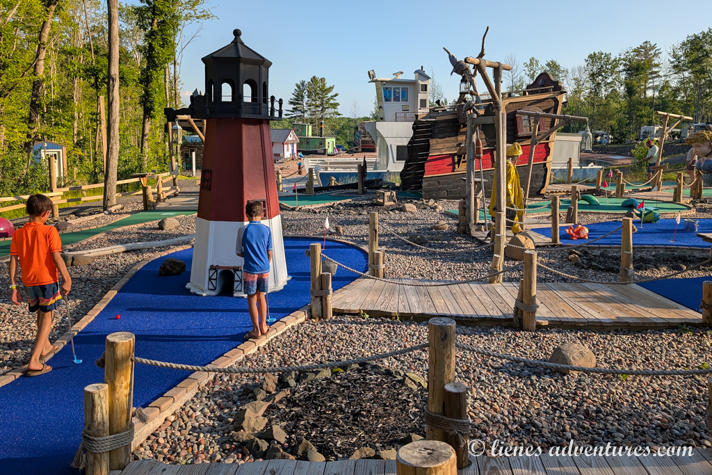
Huffing and puffing, we finally reached the campground where boys requested to go swimming and play some minigolf. The minigolf course looked quite fun, so we obliged.
We did not stay up too late, however, as we had a very long drive ahead of us the next day. We were bidding farewell to Apostle Islands National Seashore.
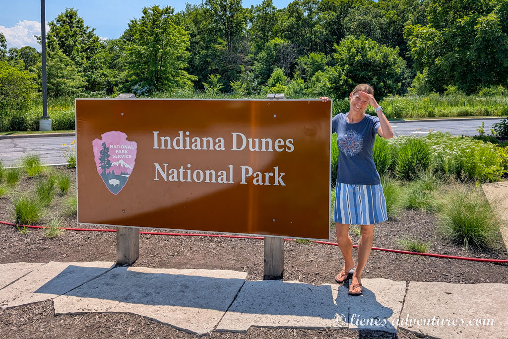
INDIANA DUNES NATIONAL PARK
INDIANA DUNES STATE PARK
Wed, July 2
This morning, we woke up around 7am to get an early start to the day. We had nearly 550 miles (885km) to drive with no sightseeing along the way, except for what we saw outside the car windows.
We had to cover the full length of Wisconsin north to south, plus fight Chicago’s rush hour traffic to make it to our campground at Indiana Dunes. Together with gas stops, short meal breaks and leg stretches, the drive took us nearly 10 hours to complete.
We set up our RV at the designated campsite and just stayed put for the rest of the night. We were too exhausted from the long drive to even walk to the dunes. Tomorrow will be a new day.
Thu, July 3
We let ourselves sleep in this morning and woke up only after sunrays started beaming on our faces. Everyone felt quite sluggish, and nobody was up for exploration, except me. The boys just wanted to zoom on their bikes around the campground roads, and my husband’s main concern was breakfast. I was not interested in either, so I opted to take a walk to the beach.
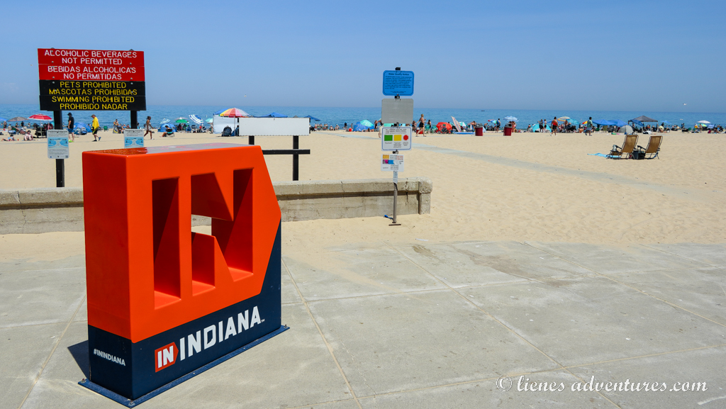
Indiana Dunes National Park was a very peculiar place. It was sandwiched between towns, cities, industrial districts and residential neighborhoods. Some of the roads required national parks access, but some were public roads. And squeezed within the Indiana Dunes National Park was Indiana Dunes State Park which was where we camped. At times it was very difficult to even understand if we were at a national park, state park or neither…
As I walked down to the beach area, I was shocked how crowded it was! Even on a Thursday morning, the parking lot was full already. There was a large building with souvenir shops, first aid station, café, restaurant and ice cream shop. And so many people! Not quite what I expected.
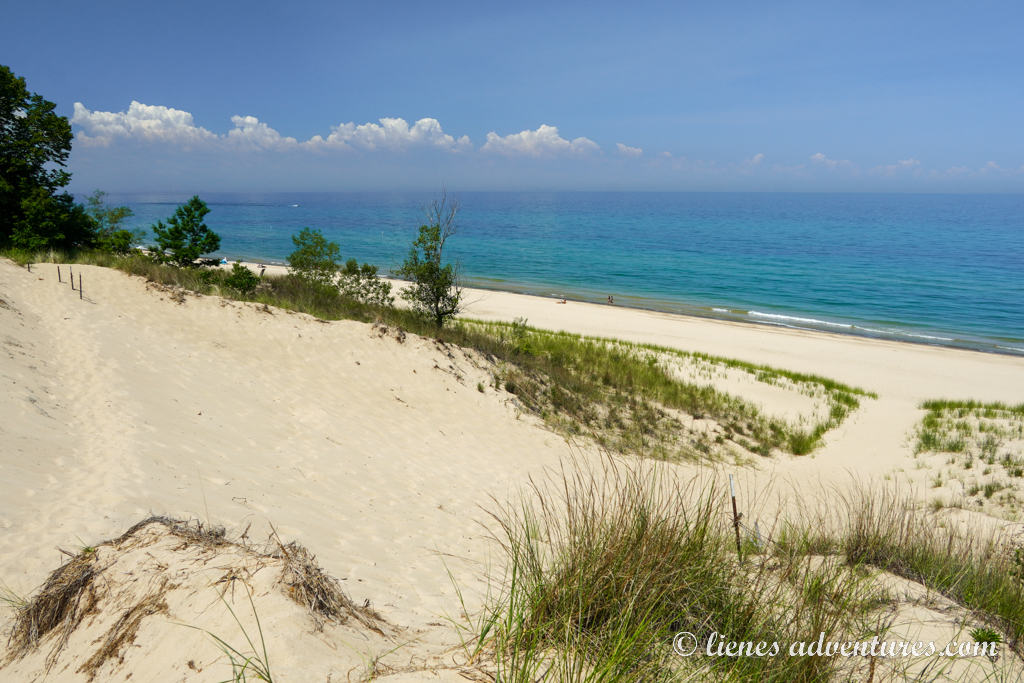
I continued on along the beach and decided to walk up the Dune Trail in order to loop back to the campground. That was not a very smart choice. The temperature was already in the upper 80s (30C), and the hot sand and no shade made the conditions even more miserable. I was wondering how long it would take for someone to find me here in case I passed out… Because there was definitely nobody as crazy as me right now, trying to climb a dune in this heat. However, once I reached the top of the 200ft (60m) tall sand dune, some trees came into view and with that – shade. From the top, it was a beautiful view over Lake Michigan.
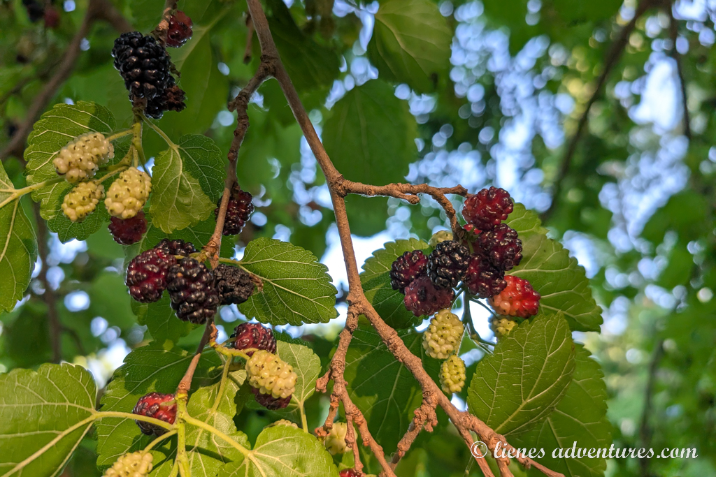
Once I made it back to the campground, breakfast was ready, and I took the next hour to recover from my not-so-smart adventures. The boys were very excited to show me all the mulberry trees they had found in the area. And it was prime mulberry season with thousands of ripe berries everywhere.
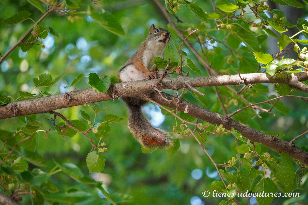
That being said, we also had a squirrel family living up in a big tree that was growing right by our campsite. Every now and then we were bombarded by falling mulberries that the squirrels dropped.
During the midday heat, we planned some indoor activities and drove out to both the state park and national park visitor centers. They had very interactive and interesting exhibits. And our kids earned their last Junior Ranger badge of the trip – the Indiana Dunes badge.
As evening approached, I finally talked my men into visiting the beach. They had to at least see it.
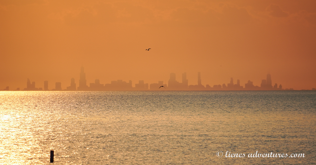
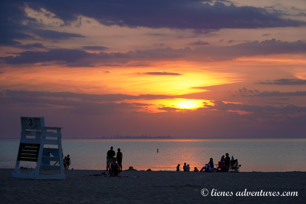
We got there right in time to wait around for sunset. It was very unexpected to stand on the beach and see Chicago skyline illuminated in sunset colors across the lake.
Kids took the opportunity to play in the sand while we waited around for the sun to set. And I am glad we stuck around – the sunset was very spectacular with cloud formations and color variations illuminating the sky. The perfect last night of our Great Lakes road trip.
Fri, July 4
Although I had reserved our campsite at Indiana Dunes for the next two nights as well, after some discussion with my husband last night, we came to a decision to start heading home-wards. The weather forecast showed temperatures soaring into the upper 90s (+36C) for the next several days. It was the 4th of July weekend which meant the beach and attractions were going to be jam-packed. And on top of it all, after two weeks we were really getting tired of sand everywhere. It just felt like we had accomplished everything we set out to do and see on this trip, and it was time to return home.
700 miles (1125km) and 13 hours later, exhausted but happy, we reached our home in Virginia.
As we returned back to our everyday life, many people we met asked us how the trip went and what we thought of the Great Lakes region. That was a tough question to answer. Over the years, we have travelled to some amazing areas of the USA – Alaska, Hawaii Islands, Southwest deserts, Florida’s Key West, the Grand Canyon, Pacific Northwest mountains, Yellowstone, and many more… All of these far surpassed the Great Lakes in grandeur and diversity. However, do we travel to compare? Or do we travel for adventures, experience and to explore the unseen? It is definitely the latter for us. And we are very grateful that we had the opportunity to finally make the trip to the Great Lakes region. Our 2 weeks there were spent watching sunsets, roasting marshmallows, admiring sea caves and arches, and swimming in freezing cold summer lakes. Those are the memories we will cherish forever.
Trip totals:
Distance: 2761miles (4445km)
Gas used: 330 gallons (1250 liters) =$868
Average mpg: 8.8 (26.7 liters per 100km)
Campgrounds:
Cleveland SE KOA, site #712 – 1 night (full hook-up), $74.99
Frankenmuth Jellystone RV Park, site #183 (deluxe site) – 2 nights (full hook-up), $191
Platte River Campground, site #1-103 – 3 nights (electric only), $54
Tee-Pee Campground, site #78 (lake view) - 2 nights (water / electric), $142.96
Munising Tourist Park Campground, site #28 – 2 nights (water / electric), $82
Apostle Islands Area Campground, site #24 - 2 nights (full hook-up), $118.82
Indiana Dunes State Park Campground, site #79 – 4 nights (electric only), $142.54
Our other RV road trips:
30 Days through South Dakota, Yellowstone and Grand Teton National Park
Wild Horses and Ghost Ships of Chincoteague and Assateague
Camping Trip in Search of Hawaii - Onslow Beach, North Carolina
Our First RV Road Trip - Georgia's Southern Charm vs Colors of the Great Smoky Mountains
Escaping Thanksgiving - Fun and Sun in Florida